
A New Lens for Life-Searching Space Telescopes
UA researchers have designed a new kind of telescope that is a cheaper, lighter and more powerful option than creating telescopes using ever-larger mirrors. With a fleet of the newly designed space telescopes, they aim to scour a thousand worlds for the chemical signatures of life.

By Makayla Mace, University Communications - August 7, 2019
The University of Arizona Richard F. Caris Mirror Laboratory is a world leader in the production of the world’s largest telescope mirrors. In fact, it is currently fabricating mirrors for the largest and most advanced earth-based telescope: The Giant Magellan Telescope.
But there are size constraints, ranging from the mirror’s own weight, which can distort images, to the size of our freeways and underpasses that are needed to transport finished pieces. Such giant mirrors are reaching their physical limits, but when they do, the UA will continue to be a global contributor to the art of gathering light and drive change in the way astronomers observe the stars.
“We are developing a new technology to replace mirrors in space telescopes,” said UA associate professor Daniel Apai, of Steward Observatory and the Lunar and Planetary Laboratory. “If we succeed, we will be able to vastly increase the light-collecting power of telescopes, and among other science, study the atmospheres of 1,000 potentially earth-like planets for signs of life.”
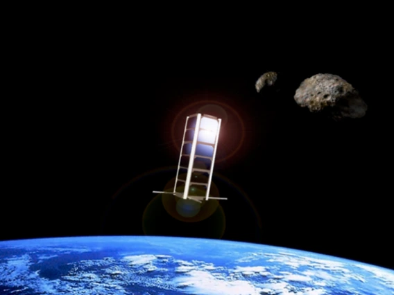
Apai leads the space science half of the team, while UA professor Tom Milster, of the James C. Wyant College of Optical Sciences, leads the optical design of a replicable space telescope dubbed Nautilus. The researchers intend to deploy a fleet of 35 14-meter-wide spherical telescopes, each individually more powerful than the Hubble Space Telescope.
Each unit will contain a meticulously crafted 8.5-meter diameter lens, which will be used for astronomical observations. One use particularly exciting for Apai is analyzing starlight as it filters through planetary atmospheres, a technique which could reveal chemical signatures of life.
When combined, the telescope array will be powerful enough to characterize 1,000 extrasolar planets from as far away as 1,000 light years. Even NASA’s most ambitious space telescope missions are designed to study a handful of potentially Earth-like extrasolar planets.
“Such a sample may be too small to truly understand the complexity of exo-earths,” according to Apai and Milster’s co-authored paper, which was published July 29 in the Astronomical Journal along with several other authors, including Steward Observatory astronomer Glenn Schneider and Alex Bixel, an astronomer and UA graduate student.
To develop Nautilus, Apai and Milster defined a goal and designed Nautilus to meet it.
“We wanted to search 1,000 potentially earth-like planets for signs of life. So, we first asked, what kinds of stars are most likely to host planets? Then, how far do we need to go in space to have 1,000 earth-like planets orbiting around them? It turned out that it’s over 1,000 light years – a great distance, but still just a small part of the galaxy,” Apai said. “We then calculated the light collecting power needed, which turned out to be the equivalent of a 50-meter diameter telescope.”
The Hubble mirror is 2.4 meters in diameter and the James Webb Space Telescope mirror is 6.5 meters in diameter. Both were designed for different purposes and before exoplanets were even discovered.
“Telescope mirrors collect light – the larger the surface, the more starlight they can catch,” Apai said. “But no one can build a 50-meter mirror. So we came up with Nautilus, which relies on lenses, and instead of building an impossibly huge 50-meter mirror, we plan on building a whole bunch of identical smaller lenses to collect the same amount of light.”
The lenses were inspired by lighthouse lenses – large but lightweight – and include additional tweaks such as precision carving with diamond-tipped tools. The patented design, which is a hybrid between refractive and diffractive lenses, make them more powerful and suitable for planet hunting, Milster said.
Because the lenses are lighter than mirrors, they are less expensive to launch into space and can be made quickly and cheaply using a mold. They are also less sensitive to misalignments, making telescopes built with this technology much more economical. Much like Ford did for cars, Ikea did for furniture, and SpaceX for rockets, Nautilus will use new technology, a simpler design, and lightweight components to provide cheaper and more efficient telescopes with more light-collecting power.
Nautilus telescopes also don’t require any fancy observing technique.
“We don’t need extremely high-contrast imaging. We don’t need a separate spacecraft with a giant starshade to occult the planet host stars. We don’t need to go into the infrared," Apai said. "What we do need is to collect lots of light in an efficient and cheap way.”
In the last few decades, computers, electronics and data-collection instruments have all become smaller, cheaper, faster and more efficient. Mirrors, on the other hand, are exceptions to this growth as they haven’t seen big cost reductions.
“Currently, mirrors are expensive because it takes years to grind, polish, coat and test,” Apai said. Their weight also makes them expensive to launch. “But our Nautilus technology starts with a mold, and often it takes just hours to make a lens. We also have more control over the process, so if we make a mistake, we don’t need to start all over again like you may need to with a mirror.”
Additionally, risk would be distributed over many telescopes, so if something goes wrong, the mission isn’t scrapped. Many telescopes remain.
“Everything is simple, cheap and replicable, and we can collect a lot of light,” Apai said.
Apai and Milster have another vision if they succeed: “Using the low-cost, replicated space telescope technology, universities would be able to launch their own small, Earth- or space-observing telescopes. Instead of competing for bits of time on Hubble, they’d get their own telescope, controlled by their own teams,” Apai said.
In January, Apai and Milster's team, along with UA assistant professor Dae Wook Kim and professor Ronguang Liang of the College of Optical Sciences and Jonathan Arenberg from Northrop Grumman Aerospace Systems, received $1.1 million from the Moore Foundation to create a prototype of a single telescope and test it on the 61-inch Kuiper Telescope on Mt. Bigelow by December 2020.
“The University of Arizona is just one of the few places in the world, and usually the first in the world, to generate such pioneering telescope systems,” Milster said. “And it fits right in line with our history and our prominence in optical sciences and astronomy that we develop this technology.”

Travel to Alien Moons with UA Expert Guides
Humans first explored the Earth’s moon 50 years ago, an impressive feat for sure. But if you are interested in venturing a little off the beaten path, here are some other extraordinary moons to visit in the future.

By Mikayla Mace and Daniel Stolte, University Communications - July 22, 2019
Pit Stop on Phobos
Your guide: Alfred McEwen, UA Regents' Professor of Planetary Sciences and principal investigator of HiRISE, the sharpest camera ever sent to another planet
As you pack up your spaceship in preparation for decades of travel, you’re sure to feel like you’re forgetting something. Don’t worry! After about nine months of listening to “are we there yet” – even when traffic is at its lightest and Mars is at its closest to Earth – one of the red planet’s moons, Phobos, is the pit-stop you need.
Although its origin is still disputed, Phobos could be a specific type of captured asteroid that is rich in water, a valuable resource for space exploration and mining. While you’re buying replacement chargers and anti-nausea pills, let the kids out to stretch their legs on this seven-mile-wide moon. As they leap about in gravity about 100 times weaker than Earth's, you should fill up your futuristic fuel tanks with water stored under the Martian moon’s surface. The fuel station’s ease of access is granted by a gravitational tug much weaker than Mars’.
While you’re there, explore the disorientingly close horizons that are distorted by Phobos' small size and rugged terrain. You’ll feel as though you are standing in an Earthly canyon and notice that its surface is surprisingly dusty, like Earth’s moon. Make sure to stop by the largest feature on Phobos, the more than five-mile-wide Stickney crater, before blasting off to the outer solar system.
Don't want to drive? Maybe you can catch a ride: Plans are in the works for Japan to send a sample return mission to the mysterious moon.
Visit the Underworld on Io
Your guide: Alfred McEwen, interdisciplinary scientist on the Galileo mission to Jupiter
Jupiter's innermost moon Io is a wicked place for only the most extreme thrill seekers. Most of what is known about Io comes from the Galileo spacecraft, which studied the Jupiter system in detail between 1995 and 2006. If you park your starship on the nighttime side, your eyes will first fall on sprawling lava flows glowing across the color spectrum because of the various elements melting within. Hundreds of volcanoes pockmark the surface of Io, each one more active than the most active volcano on Earth: Kilauea.
Make sure to take a tour of Io's top sites. The Loki caldera, or sea of lava, is the largest active volcano in the solar system. Pele, named after the goddess of volcanology of Hawai’i, is smaller than Loki but is ringed by red deposits the size of Texas (where everything’s bigger) and is one of the moon’s most prominent features.
While you might not hear the grumblings of the restless moon through the tenuous atmosphere, you will feel the terrain bucking beneath your soles and the swelling solid-body tides that reach more than 160 feet! All this activity is fueled by the planet Jupiter, which Io orbits every two Earth days, and the other large moons which regularly align to tug gravitationally on Io, heating the rocks to create the magma within.
With features named after the gods and goddesses of the underworld littering the surface, you might think you’ve died and gone to Hades. But don’t fret, Io isn't Hades, though it is a hellish place in which there are many ways to die.
You could land in a boiling caldera and vaporize. Alternatively, you could land too far away from it and freeze to death. But freezing would be a slow, sad way to leave any world, and it’s likely that on Io, you’d run out of air first. If you desperately scrambled for breath, you’d find that the thin atmosphere is actually poisonous, and your last breaths of air would smell of rotten eggs due to Io's sulfurous surface. Yet no matter how carefully you tread across the spectacularly vivid moon, the intense radiation generated by Jupiter’s magnetic field would unrelentingly destroy your cells. The noxious surface could even challenge the hardiest of robotic spacecraft. Be prepared!
Cool Off on the Solar System’s Icy Moons
Your guide: Veronica Bray, UA Lunar and Planetary Laboratory associate staff scientist developing a seismometer for a potential Europa lander
After visiting the volcanic world of Io, cool off in the frigid waters of another Jovian moon: Europa. Upon landing, you’ll notice Europa is the smoothest moon in the solar system. An icy surface of disputed thickness floats above a briny liquid ocean. The moon’s topography varies by only about 6,500 feet. The relative lack of craters and smoothness is due to a combination of geologic activity and a warm ice shell, resulting in topographic features that relax back toward a level plain.
But before you whip out your ice skates to glide along the ruddy fault lines that cut across the surface as a result of tidal squeezing, find shelter. If you are adventurous, you could set up camp in a deep ice cave; if your tastes are more refined, you might prefer a five-star hotel carved and stabilized within the ice layer. Similar to Io, on Europa, radiation from Jupiter would wreck your spaceship and your body, but water ice acts as a protective shield.
Hopefully, you’ll book ahead for the occult submarine tours in which you try to spot a Europan giant squid, though reports of their sightings have not been confirmed. Scientists think life, even bacterial life, might thrive in warm water vents on the ocean floor warmed by tidal forces.
While you might be slightly nervous about having miles of ice and water above your head, just remember that Europa’s gravity is about the same as Earth’s moon, so the pressure will not be greater than what a submarine can tolerate in the depths of Earth’s oceans. If the depths don’t get under your skin, then it’s likely that the creaking and groans of rock-hard ice echoing through the pitch-black ocean won’t either. Europan tides are responsible for the noise.
If you decide to brave the surface, acquire a certified spacesuit that protects against radioactivity. You’ll find that about 60 craters remain on Europa, which is relatively few for a moon with no atmosphere to erode surface features. The geologic activity is so great that the surface is very young. Also on the surface you might need to dodge "penitentes," vicious spikes of frozen snow sculpted by the dancing sun.
If frozen sea worlds aren’t your thing and you want to spend more time on land, travel to Saturn's tiny icy moon Enceladus to catch some powder.
Like an arctic Yellowstone, geysers erupt in Enceladus’s southern hemisphere from fissures in the surface layer of ice, much like Europa. The spray of subsurface water likely supplies fresh snow for skiing, snowboarding and sledding, and the low gravitational tug of a moon with a diameter six times smaller than Europa means you can take on steeper slopes and get more air.
What to pack: Enceladus is the brightest moon in our solar system, so bring sunglasses! Snowshoes and an umbrella can protect you from sinking into the snow or getting buried as the frozen spray falls to the ground.
A Moon like Earth, Except Totally Different: Titan
Your guide: Alfred McEwen, member of the imaging science team of the Cassini mission to Saturn
Titan, Saturn’s largest natural satellite, draws astrobiologists like moths to a flame. Observations made during fly-bys of NASA's Cassini spacecraft reveal glimpses of a mesmerizingly alien landscape of mountains, rolling hills and valleys, complete with meandering streams and lakes. Underneath its surprisingly Earth-like surface, Titan is thought to harbor a vast underground ocean of liquid water. That discovery, made only fairly recently, adds Titan to the handful of worlds in our solar system that could potentially contain habitable environments.
Titan, which is about the size of planet Mercury, offers some of the most spectacular views and experiences our solar system as to offer. For much of the final descent through Titan's atmosphere, which is thick with an orangish shroud of nitrogen and smog, you wouldn't see a lot. Picture Los Angeles on a really bad day during rush hour, multiply that by 1,000, and you get the idea.
As you approach the surface, though, ridges of steep mountains come into view, as do sand dunes and gullies carved by rushing liquid. At times, you'll catch a glint from the glass-like surface of a distant lake. Once on the ground, don a heavy space suit to protect you from Titan's harsh (in Earth terms, "polluted") atmosphere and extreme cold before you start exploring.
Your first excursion onto Titan's surface should be to visit a historic artifact: the Huygens lander – or what's left of it. The only human-made object to ever touchdown on a moon other than Earth's, the probe hitched a ride on the Cassini spacecraft with a mission to study Titan up close. Once Huygens cast off from its mothership, it hurtled toward Titan and was soon swallowed by the orange haze that hides the moon from view. Dangling from a parachute, Huygens spent two-and-a-half hours floating down toward the surface, snapping pictures with its UA-built descent imager and taking all sorts of measurements.
Next, take a leisurely trot around the shore of one of Titan's famous lakes. Where else in the solar system could you skip rocks across an endless expanse of liquid methane? Wrap up your trip with another highlight: Strap on a set of wings and, after a brief orientation on how to steer and safely land, take off and flap to new horizons, supported by Titan's dense atmosphere. Isn’t zip-lining so 2000's?
Book your travel early – NASA just approved the Dragonfly mission, which will send a quadcopter to Titan in 2034.
Looking for the Fringe? Here’s a Strange Moon You’ve Never Heard of
Your guide: Erich Karkoschka, Lunar and Planetary senior staff scientist and expert on Neptune, the pale blue giant
If you’re the type who avoids tourist crowds and finds Jupiter’s and Saturn’s moons too mainstream, consider a trip to Neso. Don’t worry if you’ve never heard of it – most people haven’t. Named after the Nereids, female water spirits in Greek mythology who accompany Poseidon, god of the ocean, Neso is the fringiest of several dozens of moons that belong to the outermost planet of the solar system: Neptune (which is how the Romans referred to Poseidon).
It’s no coincidence that Neso gets short shrift in most glossy tourism ads: This strange world is so far out that nobody knows for sure what it looks like, how big it is or how long a day lasts on its surface. What is fairly certain is that none of the other known moons get as far away from their host planet as Neso does. Its orbit is so oblong that a Neptunian observer enjoying a Neso full moon would have to wait more than a quarter-century to see another. That said, it would not be a huge loss, as attempting to spot Neso from Neptune is pretty futile to begin with, and vice versa. If you want to catch a glimpse of Neptune while standing on Neso, the big gas planet would be barely visible as a disc — not quite the breathtaking blue-marble-rising-above-the-moon, one-for-the-ages shot the Apollo astronauts managed to capture on film. The sun, too, would just be a shiny dot in the sky above Neso, just bright enough to allow you to enjoy some vacation reading.
Popular with the scruffy backpacker crowd, Neso is not for you if you consider dependable public transportation or cushy rental cars non-negotiables. But here’s the good news: Because Neso is estimated to be a mere 40 miles or thereabouts in diameter, its gravity is low enough that you can hike – or rather, hop – around the whole thing in a day or so, and it would take you just a few hundred steps. They’d be big, slow and long steps, each lasting for about five minutes. Don't worry about dropping your phone on Neso – it would take almost 30 seconds to make it to the ground, giving you plenty of time to catch it before having to check your travel selfies on a spiderwebbed screen.
While the starry night sky at the edge of the solar system likely is a sight to behold, stargazers should beware: the nightly lows on Neso spell serious trouble to the un(der)prepared. On Triton, another one of Neptune’s moons, temps go down to minus 391 degrees Fahrenheit, and while Triton holds the record as the solar system’s coldest object, Neso is unlikely to be any cozier. So be sure to bring some extra space blankets before heading out to stargaze.
Other useful items to carry on Neso include a quality flashlight, a healthy stockpile of batteries, boots with cleats to navigate rock-hard ice and pocket warmers (preferably the portable, nuclear generator kind because solar-powered devices won't work this far out).
$3M in NASA Funding to Help Students Build CubeSats
NASA's Minority University Research and Education Project Institutional Research Opportunity program will give students in Arizona and Puerto Rico the opportunity to collaborate with scientists and engineers on the next generation of space exploration technology.

By Emily Dieckman, College of Engineering - July 17, 2019
University of Arizona researchers will use $3 million in NASA funding over three years to research the low-gravity surface environments of asteroids, and to provide students from underrepresented backgrounds the opportunity to design, build and operate CubeSats, or miniature satellites at the UA.
The project was selected through NASA's Minority University Research and Education Project Institutional Research Opportunity, or MIRO, program. The UA, which was designated a Hispanic-Serving Institution in 2018, is one of eight institutions to receive a share of more than $8.2 million in cooperative agreements awarded through the MIRO program.
"This project will help us understand asteroid surface geophysics in a way that no one has done before," said Erik Asphaug, deputy principal investigator for the project and a professor in the UA Lunar and Planetary Laboratory. "And the students get to participate in a low-cost endeavor that has huge implications for how we work with asteroids in near-Earth space."
There are many reasons to study asteroids, from the way they affect humans when their orbits cross paths with Earth, to their potential as sources of spacecraft fuel, to the clues they may hold about the origins of planets and life. But it's difficult and expensive to send missions to asteroids, and it's impossible to simulate their low-gravity environments – where a human would weigh as much as a mouse – on Earth for long durations.
The answer is to build a lab in space, according to Jekan Thanga, principal investigator of the MIRO project, head of the UA SpaceTREx Laboratory and assistant professor in the Department of Aerospace and Mechanical Engineering.
The project will recreate the surface environments of asteroids by placing asteroid origins satellites, or AOSATs, small laboratories containing asteroid material that came to the Earth in the form of meteorites, into low-Earth orbit. Rotating at about the speed of the second hand on a clock, each AOSAT will generate a centrifugal force equivalent to an asteroid's extremely low surface gravity. Scientists can't recreate asteroid gravity in this manner onboard the International Space Station because it is too subtle of a force – smaller than the vibrations from the pumps and fans that keep the astronauts alive.
Because it's much cheaper and easier to operate a laboratory-spacecraft in low-Earth orbit than it is to spend hundreds of millions of dollars going all the way to an asteroid, AOSATs will offer repeated opportunities for basic science and act as a testbed for asteroid-bound hardware.
"We are coming up with an asteroid proving ground without having to go to an asteroid," Thanga said. "This is a whole different way of doing science."
Students from the UA, Pima Community College and the University of Puerto Rico will have the opportunity to build three AOSATs, each about the size of a loaf of bread. Then, they will operate them in low-Earth orbit, conducting basic research on their simulated "patch of asteroid." Research areas will include how to extract water for conversion into rocket fuel, testing robotic devices capable of digging and planting sensors on an asteroid, and sending bursts of gas and firing small projectiles into a low-gravity asteroid surface.
"This is a unique project which will provide students the opportunity to study different aspects of asteroid science," said Desiree Cotto-Figueroa, project co-investigator and assistant professor at the University of Puerto Rico at Humacao. "The continuous discovery of unknown near-Earth asteroids, as well as gaining an understanding of their origin and evolution, is very important."
Ultimately, the researchers envision AOSAT as pathway toward a significantly larger centrifugal spacecraft that could act as a semipermanent proving ground in low-Earth orbit. This accessible facility would allow researchers to realistically test how an entire lander or an astronaut might interact with an asteroid surface – what Asphaug calls a "persistent link" between distant asteroid environments and the Earth. Such a facility could even be used to recreate a "patch of the moon" where astronauts could train and adapt to the low-gravity lunar conditions humans first experienced in the Apollo missions 50 years ago.
"Our decades-spanning experience in planetary exploration makes the UA an ideal institution to lead this STEM education and research project," said UA President Robert C. Robbins. "Underrepresented students from both our local community and international partners will have an opportunity to learn about asteroid science and space systems engineering through a project that will actually launch into space. This is the kind of incredible opportunity we are proud to offer students for them to have the tools and experience to succeed."
In the near term, "we would like to build a pipeline of students working with professors to conceptualize, design, build and fly CubeSats at the University of Arizona," Thanga said. "We're looking to the day in the future where sending a CubeSat to space might be as easy as sending a payload up on a balloon flight to do an experiment in high altitude."
Roberto Furfaro, professor of systems and industrial engineering and head of the Space Situational Awareness Initiative under which SpaceTREx operates, said that with the help of the College of Engineering; the provost; and the Office of Research, Discovery and Innovation, he recruited Thanga specifically to be "the missing link" between CubeSat research and space situational awareness, or SSA, which is the ability to monitor, understand and predict the behavior of objects orbiting Earth.
"He represents what we call space-based SSA," Furfaro said. "He could potentially build a CubeSat that can not only view the Earth or other planetary bodies, but can observe other spacecraft or debris to learn more about the characteristics and behavior of objects in space, for example."
Other project collaborators include co-investigator Greg Ogden of the UA Department of Chemical and Environmental Engineering; co-investigator Dennis Just of Pima Community College; co-investigator Joseph Masiero of NASA's Jet Propulsion Laboratory; and Viranga Perera at the Johns Hopkins University Applied Physics Laboratory, who will be evaluating effectiveness and advising the team on how to meet diversity goals.
Mapping the Moon and Worlds Beyond
UA scientists were instrumental in creating the first photographic atlases of the moon, which helped NASA successfully complete the Apollo 11 mission. Fifty years later, UA scientists are busy mapping worlds throughout our solar system.

By Daniel Stolte, University Communications - July 16, 2019
In 1972, it took an astronaut going on a spacewalk to do what Lynn Carter now can do with a few mouse clicks over lunch.
Carter, a planetary science professor at the Univerity of Arizona Lunar and Planetary Laboratory, points to a small, framed photograph above her desk. It shows the Apollo 17 spacecraft, the last crewed mission to the moon, cruising high above the grey, cratered expanse below.
"See that little antenna sticking out there? That was the first planetary radar on a spacecraft, and while it went around the moon, it pinged the surface," she said. "Each time it hit a different rock layer, it reflected a signal and recorded it on film."
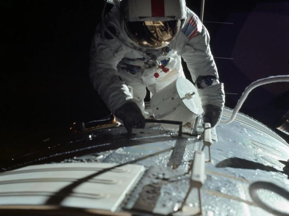
One of the things the Apollo 17 astronauts were tasked with doing was mapping the moon's surface from the bird's eye view of their orbiter. In addition to photographing the obvious – topographic features like hills, craters and boulders – the radar antenna allowed them to reveal hidden geologic features underneath the moon's surface. The radar data were recorded on old-fashioned cassette tapes stored underneath a hatch that was only accessible from outside the spacecraft. To retrieve the film, astronaut Ron Evans had to put on a spacesuit and wiggle through the hatch of the Apollo capsule while it hurtled through space somewhere between the moon and the Earth at almost 25,000 miles per hour.
"Today, it's totally different," Carter says. "Everything is digital, and the instruments have much better resolution. We can see things on Mars from our living room that you couldn't see even if you could travel there and stand on the surface yourself."
Mapping Other Worlds
Carter specializes in making maps of the unseen: using data obtained with ground-penetrating radar instruments, she visualizes and interprets features buried under the surface of planetary bodies like the moon, Mars and Venus.
To a planetary scientist like Carter, mapping another world is about much more than figuring out what is where on the surface and how to get from point A to point B (although navigation is becoming an increasingly important goal, with efforts ramping up to send astronauts to new horizons such as Mars or near-Earth asteroids).
"We look at planets to understand how they formed," Carter says, "and also to better understand features here on Earth that have been obscured by the very geologic processes that make our planet special. Studying other objects in the solar system is a way to study things that didn't turn out the way they did here on Earth."
Take Venus, for example, Earth's next-door neighbor and Carter's "favorite planet," as she readily admits. Even with the most powerful telescopes, we never get to see its surface, which is permanently shielded from view by a broiling shroud of clouds. Until the 1960s, sci-fi novels speculated about a lush, tropical world covered in jungles.
"Radar crushed that idea, as it unveiled a solid, super-hot surface with many volcanoes." Carter says. "All of a sudden, Venus did not look hospitable at all."
Unlike the explorers and cartographers who ventured out to map the Earth from land and sea, planetary scientists have to map from afar, looking through telescopes, or, if they're lucky enough to get a spacecraft mission funded, from orbit.
A Coffee Table on Mars?
One of the most successful visualization missions is HiRISE, which is led by the UA. HiRISE is a high-resolution imaging camera that has photographed Mars in unprecedented detail while orbiting the red planet aboard NASA's Mars Reconnaissance Orbiter for more than 10 years. The images are so detailed that over the course of a decade, after snapping 62,712 images, it has covered a mere 3.5% of the Martian surface. But coverage was never the goal – rather, HiRISE was sent to Mars to find future landing sites and to provide image that will help scientists understand the ancient and present-day geologic processes of Mars. The planet has proven to be surprisingly active in spite of the fact that it is a cold, dusty world lacking plate tectonics or a magnetic field and whose atmosphere largely wafted off into space.
HiRISE, whose eye is sharp enough to spot a coffee table (if there was one) on the ground from 180 miles above, is now in its fifth extension and still going strong. At the time it launched, similarly detailed maps of Earth were classified and only accessible to the individuals at the Pentagon, said Alfred McEwen, UA Regents' Professor of Planetary Sciences and principal investigator of HiRISE.
Since then, HiRISE has revealed a stunningly beautiful planet. The instrument's stereo vision, unprecedented resolution and repeated imaging passes completely changed how scientists interpreted previous images taken of the red planet, McEwen says.
"What we thought to be ancient dunes, for example, frozen in time for possibly millions of years, turned out to be changing constantly."
HiRISE has seen a whole suite of ongoing activity including new impact craters, where the impacting meteorite blasted water ice out from underneath the planet' surface, erosion gullies and other features, some so unearthly that planetary geologists like McEwen are still struggling to explain their origin with certainty.
"We keep finding new things, such as features in the polar regions that we call spiders," McEwen says. "We think they're caused by carbon dioxide gas flowing underneath ice sheets, carving the surface topography. Another recent discovery is boulders that slowly move downhill, possibly driven by the seasonal expansion and contraction of ice underground."
Taking pictures is only the first step in generating a map of a planetary surface accurate enough to allow landers to touch down without crashing into undiscovered boulders or prevent robotic rovers from getting stuck in loose sand.
"To make a map, you have to understand the geometry of your images and mosaic them together. And then you have to change the perspective to what it looks like straight down, unless the originals were acquired that way," McEwen said of the process called orthorectification.
Orthorectification is necessary to derive the topography from an image, he explains. The UA scientists who produced the first detailed atlas of the moon used a rather analog, but elegantly simple setupto accomplish this. These days, it is done by the keen eyes of specially trained people and sophisticated software.
Jupiter's Shapeshifting Satellites
Some of the other challenges facing cartographers of the solar system are how to define sea level when your object of study doesn't have a sea or how to nail down coordinates on an object that's not exactly spherical or constantly shifts its shape.
"Many of the Jupiter satellites are what we call triaxial ellipsoids," McEwen says. "Their three-dimensional shapes change with the strong tidal forces under Jupiter's gravitational field, and that is a real challenge if you want to do precision mapping."
Measuring such changes is interesting for its own sake, however, because it reveals clues about the interior properties of those objects that would be difficult or impossible to study otherwise, McEwen adds.
UA scientists and engineers have pushed the field forward by designing instruments and cameras that have flown on several space missions to map unknown territory, including Mercury, the planet closest to the sun, Saturn's moons Titan and Enceladus, and Jupiter’s moon Io. They also are working on proposed instruments for future mapping projects that include Earth's moon, Mars and Europa, Jupiter's large moon whose subsurface water ocean is considered a hot candidate for extraterrestrial life.
Most recently, UA scientists are nearing completion of the most detailed map ever made of any solar system body, including Earth: cameras designed at the UA are scanning the rocky surface of Bennu, a near-Earth asteroid about as tall as the Empire State Building, and the team of the UA-led OSIRIS-REx sample return mission mapped Bennu's surface down to the inch. Being able to select a safe site for the spacecraft to touch down and grab a sample is a logical prerequisite for the mission, which is poised to return a sample of pristine asteroid material to Earth in 2023.
"By the time we're done with the characterization of the candidate sample sites, we'll be able to see an object the size of a penny," says Daniella DellaGiustina, lead image processing scientist for OSIRIS-REx.
DellaGiustina adds that in addition to ensuring mission safety, mapping at such unprecedented detail delivers "really cool, incredible science."
"By getting a dataset of an entire asteroid and going from that scale all the way down to centimeter-sized pixel imaging, we can really begin connecting asteroids to the meteorite population we have in our labs," DellaGiustina says.
To do so, the team had to invent new techniques and augment available mapping software to capture an accurate representation of Bennu, an irregularly shaped object whose surface is studded with boulders, including some the size of a parking garage and with overhang.
Navigating in Three Dimensions
"One coordinate system is not enough, so we are working in both latitude and longitude and cartesian coordinates all the time," DellaGiustina says. "This allows us to generate 3D point clouds and assign precise coordinates to every pixel."
Covering new ground for future touch-down sites also is a declared goal of ongoing Mars research at the UA, including a shallow-ground radar mapping mission proposed by Lunar and Planetary Laboratory Deputy Director Shane Byrne. One of the requirements is to look for water ice deposits shallow enough that astronauts can get to them and use them as a resource for fuel and water. Meanwhile, the HiRISE team is currently scouting potential landing sites on Mars' midlatitudes for Elon Musk's Space X company.
Through recent hires of radar mapping experts, the UA has become one of the premier institutions for radar imaging science, says Ali Bramson, who recently graduated with a Ph.D. from the Department of Planetary Sciences and now is a postdoctoral fellow in Carter's group. Together with Eric Petersen, a postdoctoral fellow on the team of professor Jack Holt, who joined the Lunar and Planetary Laboratory last year, Bramson is part of a project that integrates datasets from many different imaging techniques to paint a more complete picture of ice hidden underneath the Martian surface. The goal is to produce a data product that could be used in planning crewed missions.
In addition to enabling future human exploration missions to Mars, this research helps answers fundamental questions about how the red planet came to be what it is today, Bramson explains.
"By mapping the subsurface ice, we can try to piece together the planet's climate history," she says. "This allows us understand the natural climate shifts without the confounding factors that we have on Earth, such as human population, vegetation and oceans."

Exploring A Desert Portal to Other Worlds
The merge between astronomy and geology, necessary to get humans to the moon, led to the birth of modern-day planetary science and a long history of field trips that continue to this day, enabling fledgling scientists to interpret data from far-off worlds without leaving Earth.

By Mikayla Mace, University Communications - July 8, 2019
Ali Bramson clutched her neon pink umbrella as she trekked across the frozen lava that spilled from Amboy Crater in California’s Mojave Desert. She and her fellow University of Arizona graduate students were tasked with identifying the boundaries of different eruptions of the extinct volcano, then unfurling their bright umbrellas to mark the spot. From an airplane overhead, her professor and another student photographed the sites to record the findings.
“We compared where we had mapped the different lava flows from the ground to where we had mapped the lava flows based on images taken from above by airplanes and satellites,” said Bramson, who is now a postdoctoral research fellow at the UA's Lunar and Planetary Laboratory, or LPL. “It was a great way to learn about how looking at geological features from different perspectives and spatial scales affects your interpretation.”
Bramson was one of the latest in a long history of LPL graduate students to take a planetary geology field trip to learn how Earth’s geological formations can serve as analogs to formations on the moon, Mars and beyond.
The tradition began more than 50 years ago – before Neil Armstrong and Edwin “Buzz” Aldrin left their bootprints in the moon's powdery soil – when UA researchers led by Gerard Kuiper worked with NASA to map and understand the moon’s surface from a geological perspective.
To do so, Kuiper’s graduate students studied field geology, which spurred the formation of the UA Department of Planetary Science and the field trips within it.
“The smallest features we could photograph from Earth were no more than a half-mile across, so the biggest problem was to understand the human-scale structure of the lunar surface,” said William Hartmann, one of Kuiper’s graduate students who helped create the Rectified Lunar Atlas. Hartmann later co-founded the Planetary Science Institute, or PSI, in Tucson. “To study possible lunar surface textures, we Kuiper graduate students in the early ‘60s – who had grown up in leafy-green, non-volcanic parts of the U.S. – made many camping trips.”
Desert Portal
Clear skies, clusters of telescopes, and thriving astronomy, geology, and atmospheric science programs lured Kuiper, considered the father of modern-day planetary science, to Southern Arizona in 1960. But it is the Sonoran Desert's arid climate that preserves the geological features of interest: impact and volcanic craters, lava flows, cinder cones, strata within canyons, and more.
“These geological processes are beautifully exposed and preserved in the Southwest,” said LPL assistant professor Christopher Hamilton, who co-leads the LPL graduate student field trips with Shane Byrne, assistant department head of planetary sciences. Their trips have allowed students to explore sites across the Sonoran Desert and as far away as Hawaii and Iceland.
“The field trips also offer a way to see things, like lava flows or sand dunes, up close that for other planets we often have to rely on images and data from spacecraft to study,” Bramson said. “It helps connect what we see from orbit or telescope to a ground truth by being able to walk around and sample similar features here on Earth.”
The Pinacate Peaks are one such example, and they are riddled with lunar analogs, according to Kuiper’s graduate students. More than 400 volcanic cinder cones and nine large volcanic craters have pockmarked the range, which is located mostly in the Mexican state of Sonora between the Arizona-Mexico border and Puerto Peñasco, and is surrounded by giant sand dunes.
“The Pinacate region has wonderful lava flows and big half-mile volcanic craters,” said Hartmann, who in 1989 wrote Desert Heart, a popular book about the area. “One of the big concerns was that the lunar surface might resemble extremely rugged types of lavas with spikey, jagged rocks all over the place. The Apollo astronauts later trained for lunar exploration in that same area.”
Dale Cruikshank, a research scientist at NASA Ames Research Center, also studied under Kuiper and remembers the trips well: “We would crawl inside the volcanic craters and around and examine as a geologist would. Kuiper was tromping around lava flows with us sometimes.”
Kuiper’s students also visited Meteor Crater and Sunset Crater, both near Flagstaff in Northern Arizona, to understand the difference between craters formed by impact and magma chamber collapse, respectively.
“Hartmann and I got a personally guided tour of Meteor Crater by Eugene Shoemaker,” Cruikshank said, adding that Shoemaker worked with Kuiper’s group during the robotic missions that preceded the crewed lunar landings and created the astrogeology branch of the United States Geological Survey in Flagstaff. “Others in Flagstaff were also very good to us and flew us around in an airplane. It was terrific.”
Kuiper’s students also ventured into the Dragoon Mountains, where they examined rocks types that might be found on the moon, and to Hawaii, where they investigated how magma flows and cools as it might have on the moon billions of years ago, Hartmann said.
Multiple faculty members from the Department of Geosciences led the first field trips, but the most prolific of all was Spence Titley. Now retired, Titley was a leading mining and resource geologist at the university. During some of the field trips, he trained Apollo astronauts in lunar geology and recommended lunar features they later photographed from orbit. In 1964, he collaborated with the U.S. Geological Survey to map the moon for the Apollo program using the McMath-Pierce Solar Telescope on Kitt Peak.
Interpreting the Data
“Field trip locations are not just focused geographically, but also by process,” Hamilton said. “With each trip you’re not just visiting a place, but different times in Earth’s history.”
Most field trips focus on investigating volcanic landscapes. Volcanic activity is the most dominant process in planet formation; It underpins planetary creation and evolution, Hamilton said. The moon is a good example: The dark spots were once thought to be oceans, but they are actually volcanic lava flow fields. About 3.5 billion years ago, the lunar surface was glowing with red-hot magma, he said.
Other processes highlighted on LPL field trips include impact cratering, tectonic plate movement, and erosion by water and air.
“When you build a model that tries to describe the complexity of planetary evolution, you have to make a cartoon version of it,” Hamilton said. “Going into the field and determining the necessary detail of the model – what to leave in and out – is important to understand.”
“We discuss how features might work similarly or differently on another planet. Other planets or moons might have different gravity, atmospheres and sunlight, for example,” Bramson said.
Seeing these formations in real life helps students interpret remote sensing data sent back from different places in the solar system, says Hamilton, whose most active area of research is in terrestrial analog study. He travels to extreme environments to test how robotic instruments might perform on alien worlds.
“Climbing around lava flows similar to those on the moon or Mars, or dunes on Mars and Titan, provides a connection with otherwise abstract data,” he said.
“We took students to Cape Canaveral to look at coastal processes we can’t see in Arizona as an analog for Mars, which has many shorelines associated with the northern ocean and impact craters that filled with water to create lakes,” Hamilton said, adding that Saturn’s moon Titan also has oceans but composed of liquid methane and water ice as hard as rock. “It’s another permutation of the same processes."
Bramson entered her graduate program with a bachelor’s degree in astrophysics, so, like many of her classmates, the field trips were her primary lesson on geology. But she learned about more than just geology, she said.
“With all the time spent together – driving to the field sites, hiking and discussing the landscape, camping, making food around the campfire at night – I got to know my fellow graduate students a lot better on these trips,” she said. “Many became some of my best friends and collaborators on scientific projects.”
From Points of Light to Worlds: UA Explores the Solar System
A determined bunch of scientists set out to map the moon in preparation of the Apollo landings, but that was only the beginning. A new field of science blossomed, and UA scientists have been involved in nearly every U.S. space mission since.

By Daniel Stolte, University Communications - July 3, 2019
Here's a fun thought: Imagine if University of Arizona scientists got to keep a replica of the spacecraft for every space mission in which they've been involved.
The collection of space-faring gadgets they would have amassed by now likely would fill all five stories of the UA's Kuiper Space Sciences Building. Tourists from around the world would flock to campus, drawn by an array unlike any other, bristling with space probes, robotic rovers, extraterrestrial telescopes, glinting satellites and other ingenious apparatuses designed and launched over the past half-century of space exploration.
From Probes to Planetary Science
The first exhibit a visitor to our imaginary exhibit of space memorabilia would come across is Ranger, a series of lunar reconnaissance probes designed to record high-resolution images of the lunar surface during a descent ended by a deliberate crash-landing.
Next would be Surveyor, a series of three-legged, solar-panel-topped contraptions NASA sent to the moon between 1966 and 1968 to test the feasibility of soft landings on the moon's sea of dust. Both missions have deep ties to the beginnings of planetary science at the UA.
Not many people can say they were there when a new area of science was born, but Steve Larson can. Larson first got his feet wet – or rather, his boots dusty – trotting across lava fields and volcanic craters during field trips as one of the first freshmen to study planetary science at the UA, soon after Gerard Kuiper founded the university's Lunar and Planetary Laboratory, or LPL.
Ranger and Surveyor were crucial in paving the way for the first manned moon landing in at the end of the decade, and NASA enlisted the help of Kuiper and Eugene Shoemaker, a contemporary planetary scientist who served as the first director of the United States Geological Survey's Astrogeology Research Program.
"Those two were the only people who knew about this stuff," Larson says. "They agreed that Kuiper would do Ranger, and Shoemaker would do Surveyor."
Larson remembers being in Kuiper's' office once with Shoemaker there. Spread out on the table was a large print of the moon surface.
"Kuiper was used to observing through telescopes, so he wanted south to be up, and Shoemaker worked with maps, so he wanted north to be up," Larson says. "They ended up standing at opposite ends of the table, pointing out features on the map, and both were perfectly happy."
The episode illustrates how planetary science came into existence – through an enthusiastic, at times rocky, marriage of disciplines that traditionally didn’t have much to do with each other. Astronomers who knew how to operate telescopes were needed just as much as geologists who understood the inner workings of planetary bodies; physicists and engineers were crucial in inventing and advancing various methods of imaging and detection, as well as chemists adept at teasing out mineral compositions from meteorite samples.
"At that time it was only LPL, there was no Department of Planetary Sciences," says William Hubbard, one of the first faculty Kuiper hired when he established an academic department. " thought that in order to ensure the longevity of the whole enterprise, we needed an academic arm – we needed to have graduate students, we needed to have a teaching program."
Hubbard, who was trained as an astronomer, remembers teaching the first planetary science course offered to undergraduate students. Unsure of what such a course should entail, Hubbard teamed up with Mike Drake, a young and energetic colleague who, like Hubbard, would later serve as department head. Each would teach half of the course, and to help each other evaluate and improve their teaching, the two sat in on each other's lectures to observe.
"After I had sat through one of Mike's lectures, I said, 'Gee, I didn’t' know all this stuff,'" Hubbard says, "and Mike just laughed and said the same about my lecture. That taught us we had to be more aware of what other departments and other disciplines were doing."
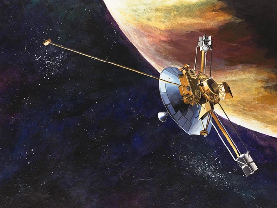
Hubbard dedicated much of his career to unlocking the inner workings of planets in the outer solar system such as Jupiter, and although formally retired, he is involved with NASA's Juno spacecraft.
Send the Machines
Juno's replica would be a commanding sight: The furthest venturing craft to rely on the sun for power, Juno is mostly solar panels that loom overhead like a windmill, large enough to cover a basketball court.
After Juno, tucked into a corner of the the LPL's imaginary hall of fame is what looks like a shoebox with an upside-down tripod mounted on its top. Built by Charles Sonett, the instrument, a magnetometer, traveled to the moon with Apollo 16 and gathered clues about the moon's core.
In 1973, Sonett had been invited by Kuiper to succeed him as the director of the LPL and first head of the newly minted planetary science department. Sonett was involved in spacecraft missions that dramatically advanced our understanding of the solar system and beyond, including the Pioneer, Explorer and Apollo programs. He is credited for expanding the LPL's research into cosmic riddles that could only be solved by sending robotic explorers out to space to investigate phenomena such as interplanetary plasma, a soup of particles, cosmic rays and dust embathing the solar system.
Planetary science had come into its own. Larson, one of the new department's first students and now a senior staff scientist at the LPL, remembers what he calls "electrifying times."
"If you wanted to study anything in the solar system, the UA simply was the place to be," he says. "Our planets evolved from points of light to actual worlds, and LPL has driven that evolution. When I first started, we looked at the points of light, and they became little discs. Now, a half century later, we land on them, we dig on them, and we bring samples back to Earth."
The plethora of spacecraft in the LPL's imaginary museum would bear witness to the story of how discs of light, one by one, were turning into worlds with exotic interiors, alien atmospheres and – in some cases – menageries of moons.
There was Pioneer, with its famous golden plaque sporting depictions of human figures in what was meant to be a greeting to other civilizations should any ever encounter the spacecraft. As the probe flew by Jupiter and Saturn, its spin swept a photopolarimeter, developed by former LPL professor Tom Gehrels, across the planets, assembling the first close-up images of the giant planets.
There were the Voyager probes, bearers of the famous "golden record." Voyager 2 took the only close-up images we have of Uranus and Neptune to this day, and its twin, Voyager 1, became the first manmade object to leave the solar system. The imaging team was led by former LPL professor Brad Smith.
Further down the hall would be Cassini-Huygens. A towering probe the size of a school bus, Cassini-Huygens brought the exquisite, otherworldly beauty of Saturn and its moons to desktop wallpapers worldwide. Many UA planetary scientists and their students were directly involved in this mission, which included the first landing on a moon other than Earth's. The descent imager aboard the Huygens lander, developed by an LPL team led by Martin Tomasko, captured its descent through the thick, hazy atmosphere of Saturn's moon Titan onto a frozen, alien landscape, including lakes of liquid methane.
Titan is also the target of Dragonfly, NASA's newly selected New Frontiers mission. Dragonfly will send a quadcopter drone to look for signs of life the icy moon's origins. The mission team includes – you guessed it – many former UA planetary science students.
"The first time you go to one of these places, you learn a lot," says current LPL Director Tim Swindle. "It's completely different from what you thought you knew from when you looked at it from afar. At LPL, we have been part of many of those first looks at these worlds."
Back to the Moon and on to Mars
Swindle is excited about the possibilities the next 50 years may hold in store for planetary exploration.
"We are going back to the moon, where we'll be doing all sorts of new experiments on the surface," he says. "The things we are doing right now with OSIRIS-REx to prepare for sample return from asteroid Bennu are the same things we'll be doing to prepare to bring back samples from Mars."
Swindle also is confident that LPL programs, which have found about half of the known near-Earth asteroids, will continue to lead the way in discovering more.
"Once we start further exploring asteroids, we'll send mining robots rather than exploration robots," he says, "and perhaps some day, even people. I think LPL will be a part of all that."
Who knows, 50 years from now, a space exploration museum on the UA campus may be a reality, as well. Until then, visitors to the Charles P. Sonett Space Science building, across the street from Flandrau Science Center & Planetarium, can peer down the telescope barrel on a life-size model of the UA-led HiRISE camera, which has been photographing Mars in stunning detail for more than 10 years.
Learn more about the Lunar and Planetary Laboratory's space exploration efforts in the current and former space mission rosters.

Undergraduate Students at Work on OSIRIS-REx
When she’s not in class or training to qualify for next year’s Boston Marathon, you can find undergraduate Stephanie Stewart hard at work with her teammates on OSIRIS-REx, NASA’s first asteroid sample return mission.

By Emily Litvack, Office of Research, Discovery & Innovation - June 28, 2019
Stephanie Stewart’s work on the University of Arizona-led OSIRIS-REx mission began in earnest in February, soon after the NASA spacecraft arrived at its destination, the asteroid Bennu.
Stewart learned about the OSIRIS-REx mission through her roommate Natalie Schultz, a UA student majoring in optics and engineering and a researcher for the mission. As someone who was passionate about data systems, Stewart wanted to contribute to NASA’s first mission to collect rocks and dust from an asteroid and bring it back to Earth. She figured a feat like that must involve lots and lots of data.
Right she was. The UA undergraduate, now a junior majoring in management information systems at the Eller College of Management, joined a team tasked with ensuring a flawless five-second operation to collect and stow away dust from the surface of Bennu. The team’s job: Scouring image after image of Bennu, looking for a spot to land.
“The entirety of the OSIRIS-REx mission is breathtaking and inspiring,” Stewart said. “After this mission, we will have samples of Bennu here on Earth that we can use to further piece together the profound history of our solar system.”
Q: What do researchers hope to learn by studying rocks and dust from the surface of Bennu?
Stewart: Although there are several objectives for this asteroid sample return mission, gaining a deeper understanding of how planets formed and life began is at the forefront. Our solar system has millions of asteroids, but Bennu is classified as a near-Earth asteroid and is therefore easier to access. Due to their considerably ancient existence, asteroids can provide us with a better understanding of the building blocks of our solar system and the creation of Earth. One thing to remember is that up until now, we have used instruments that have only been calibrated to samples here on Earth. After obtaining samples and more data from Bennu, we can have a better understanding of the accuracy of our instruments in measuring items that are far away.
Q: What’s the next big milestone for the OSIRIS-REx mission and what will be your role in it?
A: The OSIRIS-REx team is in the process of narrowing the original 50 regions of interest to just a handful of possible landing sites. When we originally started this mission, researchers assumed that the ideal areas would be instantly visible, but as we approached Bennu, we realized this wasn’t the case. Ideally, the landing site should have sand-sized samples, but finding an area with rocks the size of a couple centimeters has been a challenge. Looking ahead, we will be obtaining more detailed images and comprehensive data of the potential sites so that we can narrow the region of interest to one. When a final area is chosen, we will collect even more detailed images and data.
Q: You work on the team identifying a "safe" place to collect samples of the asteroid Bennu. How does the team go about figuring out what’s safe?
A: I specifically work with boulder identification, meaning I look at sites of interest and take note of the number, clustering and size of the rocks in a particular area. As Keara Burke, a systems engineer and data analyst for the mission, explained, the Touch-And-Go Sample Acquisition Mechanism, or TAGSAM, can only collect rocks up to about three-quarters of an inch in dimeter. Rocks larger than 21 centimeters can block the entire collection head, and rocks taller than five centimeters can cause the TAGSAM to tilt, affecting how much the chamber can collect. Therefore, it is imperative that boulder identification is both accurate and precise for this mission to be successful.
Q: Did the mission doing anything special to celebrate Asteroid Day this year?
A: Yes! Dolores Hill, the co-lead of the OSIRIS-REx Target Asteroid Program, gave a presentation titled “OSIRIS-REx Encounters Asteroid Bennu” at the UA’s Flandrau Science Center and Planetarium on Sunday, June 30. She talked about the exciting new science that has been discovered since the OSIRIS-REx spacecraft has reached Bennu. She also explained the surprises encountered since the spacecraft’s arrival this past December, the next steps for sample acquisition, and the TAGSAM that will be used for the five-second collection.

How the UA Guided Men to the Moon
The maps and images created by a small UA team at the start of the space race opened the door for lunar and planetary exploration 50 years ago.
By Mikayla Mace, University Communications - June 26, 2019
Only a handful people were seriously studying the moon when President John F. Kennedy announced in 1961 that Americans would walk on its surface by the decade’s end. Among them was a small group of researchers at the University of Arizona.
The UA team imaged and mapped the lunar surface, which allowed them to understand the moon’s geology and NASA to choose landing sites for future robotic and Apollo missions. Gerard Kuiper, the father of modern-day planetary science, led the team and established the UA Lunar and Planetary Laboratory.
“Classic astronomers regarded the moon as an annoyance that lit up the night sky, making it hard to study the faintest stars and galaxies,” said William Hartmann, one of Kuiper’s first graduate students and co-founder of the Planetary Science Institute, or PSI, in Tucson. Hartmann and PSI co-founder Don Davis, another UA alumnus, also proposed that the moon was born from a giant impact with the Earth. Their theory still leads thinking today.
“Back then, astronomers were interested only in objects outside our solar system,” Hartmann said. “To most 1950s astronomers, the planets did not seem very interesting, and there weren't very useful techniques for studying them.”
Moreover, moon maps at the time were drawn by hand, and the names of many features remained unsettled.
Kuiper, already a leader in planetary science by the time he arrived in Tucson in 1960, sought to understand Earth’s celestial neighbor and worked for years to create multiple lunar atlases with the best photographs of the moon.
The Lunar Atlases
Kuiper and his team collected the best available telescopic photos of the moon from observatories around the world and used them to produce the first two atlases while working at the University of Chicago’s Yerkes Observatory in Wisconsin. The Photographic Lunar Atlas and the Orthographic Atlas of the Moon, which included a coordinate grid, were published in 1960 and 1961, respectively. Astronomers used these while observing the moon telescopically.
The Rectified Lunar Atlas, published in 1963 by the University of Arizona Press, went a step further. The third atlas allowed humans for the first time to see what features on the moon’s edges, called limbs, looked like without distortion.
To accomplish this, Kuiper mounted a 3-foot-wide white hemisphere at the end of a hallway and projected glass plate photographs of the best images of the moon onto it. Hartmann, a first-year graduate student at the time, was tasked with snapping photos of the hemisphere from different angles. The resulting images revealed lunar features as they would appear from the perspective of an astronaut flying overhead.
Four years later, Kuiper produced yet another lunar atlas.
“The 1967 Consolidated Lunar Atlas was the last in the series of Gerard Kuiper,” said Steve Larson, who was one of Kuiper’s undergraduate research assistants and is now a senior staff scientist at the UA Lunar and Planetary Laboratory, or LPL. Larson established the Catalina Sky Survey and has worked under every LPL director since the lab’s inception.
The fourth atlas was comprised of the highest resolution images taken from the ground, most of which were taken using the NASA-funded 61-inch telescope perched atop Mount Bigelow in the Catalina Mountains north of Tucson. The telescope is now managed by the UA's Steward Observatory and bears Kuiper’s name.
“That was our main project for the first couple years after the construction of the 61-inch telescope,” Larson said. “We were funded by NASA to record high resolution images of the moon, but we also took images of Venus, Mars, Jupiter and Saturn to monitor changes in atmospheres."
Kuiper and his team created the Consolidated Lunar Atlas by carefully focusing the telescope on the moon and systematically snapping thousands of film photos along the moon’s terminator, the boundary between sunlight and darkness. At the terminator, sunlight hits the moon at a low angle, allowing the scientists to capture subtle variations in the lunar topography, Larson said.
But the high contrast and dramatic lighting near the moon’s terminator made imaging the lunar surface features tricky. Larson and undergraduate John Fountain laboriously brightened the areas near shadow and dimmed the brighter parts of the surface by hand.
“It was very analog,” he said. “I spent the whole summer monsoon season down in the basement dark room; The sun was shining when I went down, and when I came out it’s flooding everywhere.”
Kuiper and his team inspected, cataloged and graded each of the more than 8,000 film photos to whittle them down to the more than 200 which now comprise the Consolidated Lunar Atlas. It was published by the University of Arizona Press in 1967.
Landing the Eagle
At the same time, leaders at NASA knew they needed to understand the surface of the moon in detail to choose a landing site. Would the smooth, dark swaths of lunar surface – called maria, which means seas, as the earliest observers thought they were oceans – swallow the astronauts in dust or support them as cooled and solidified oceans of magma?
“When NASA was deciding where to land, they’d be looking at one of these prints. Here’s a spot with not a lot of craters that’s relatively flat,” Larson said as he pointed to the final Apollo 11 landing site, located in the Sea of Tranquility.
There are two main types of terrain on the moon, said LPL professor and planetary science assistant director Shane Byrne.
"Most of the Apollo missions and most of the Surveyor (lander) missions went to one type: the lunar mare, the dark areas of the moon," Byrne said. "It's smoother and safer to land there, and that was the motivation for sending the astronauts there. But most of the moon is covered with the bright areas, the lunar highlands, which are much rougher, much more cratered."
Before Men, There Were Robots
NASA prepared three series of robotic spacecraft to visit the moon ahead of the astronauts: Ranger, Surveyor and Lunar Orbiter.
NASA appointed Kuiper as chief experimenter, a position today referred to as principal investigator, on the Ranger missions. Among the team were UA planetary scientist Ewen Whitaker and Eugene Shoemaker, who created the astrogeology branch of the United States Geological Survey in Flagstaff, Arizona.
Ranger 1 launched August 1961 to collect video of increasing detail before crash-landing on the moon. Future Ranger missions failed until the 1964 launch of Ranger 7, which landed in what Kuiper dubbed Mare Cognitum, the Sea That Has Become Known. Whitaker selected the landing sites for Ranger 6 and 7.
The successful Ranger 7 mission improved the resolution of lunar detail 1,000 times over, Kuiper proclaimed at a press conference shortly after the spacecraft reached the moon.
To analyze the photographs, Kuiper partnered with UA professors emeritus Robert Strom of LPL and Spence Titley, of the Department of Geosciences. Titley gave Kuiper’s students and NASA’s astronauts crash courses in geology and recommended features the astronauts should photograph from orbit. Titley also worked with the U.S. Geological Survey in 1964 to map the moon using the McMath-Pierce Solar Telescope on Kitt Peak for the Apollo program.
The Ranger missions were followed by Surveyor 1, the first of seven unmanned lunar landers in a program that ran from June 1966 through January 1968. Surveyor 1 reached the surface of the moon on June 2, 1966, and sent back panoramic photos from its travels.
Surveyor’s success reassured the astronauts they would not be swallowed by dust. Despite the success of the Surveyor program, NASA had no way of knowing where, exactly, on the moon the spacecraft landed.
NASA published what they thought was the correct landing site in the journal Science. But Whitaker noticed a discrepancy, and after poring over images taken by NASA Lunar Orbiter, he published an alternate location for Surveyor 1 in the journal’s September issue.
“Whitaker was able to pinpoint the landing area by looking at mountain peaks on the horizon,” Larson said.
NASA officials realized their mistake and Whitaker’s skills earned him the task of locating four more Surveyor landing sites.
Whitaker again proved his prowess of the lunar surface when he correctly located Apollo 11. The first manned mission didn’t hit its intended target because the site was too rocky. The lander carrying the two men cruised for four additional miles, nearly running out of fuel before it touched down. NASA anlyzed photos taken from the surface and determined what they believed to be the Apollo 11 landing site. Ewen did his own analysis, which was contrary to NASA's location, and was correct.
NASA then sought to demonstrate a pinpoint landing with Apollo 12 and used Whitaker’s location of Surveyor 3 to do so. Whitaker’s location was so spot on that the astronauts walked to Surveyor 3.
Since the Apollo missions, the UA has imaged the surface of Mars in great detail using the High Resolution Imaging Science Experiment aboard the Mars Reconnaissance Orbiter. The UA also led the team that imaged the surface of Saturn’s moon Titan from under the clouds with the Cassini-Huygens probe. The UA is also heading up the OSIRIS-REx sample-return mission to the asteroid Bennu and is currently mapping and imaging the dark surface to choose a collection site.

Ion Beams and Atom Smashers: Secrets of Moon Rocks
Moon samples collected by the Apollo astronauts a half-century ago hold answers to questions that weren't even on scientists' minds at the time, as new technological tools provide insight into some of the oldest mysteries about the moon, the earth and the solar system.
Moon samples collected by the Apollo astronauts a half-century ago hold answers to questions that weren't even on scientists' minds at the time, as new technological tools provide insight into some of the oldest mysteries about the moon, the earth and the solar system.
By Daniel Stolte, University Communications - June 18, 2019
On July 20, 1969, as Apollo astronaut Neil Armstrong climbed down the ladder from the "Eagle" lunar landing module, he found himself surrounded by a sea of grey – an expanse of powdery dust no human had ever seen in person. The iconic print made by his left boot marked but the first step on a long journey of discovery, a discovery about the moon and our own world – both of which hold secrets that scientists are only beginning to uncover.
Fifty years after the Apollo astronauts collected samples of moon rocks and dust during their forays across the lunar landscape, there are still mysteries to be solved, and one University of Arizona scientist is looking for answers. Jessica Barnes, an incoming assistant professor in the UA's Lunar and Planetary Laboratory, was recently selected by NASA to receive access to preciously unopened moon rock samples.
Under NASA's Apollo Next Generation Sample Analysis, or ANGSA, program, Barnes will be granted access to Apollo 17 sample 71036, which contains almost four ounces of rock. Several samples from that mission were initially processed under nominal laboratory conditions, protected from air exposure by a nitrogen cabinet at room temperature, and were then placed into cold storage within one month of return.
"When these samples were brought back, the curators had the foresight to say, 'in this moment we don't have all the methods to answer all the questions these samples could help us answer' and so they locked some away for future study," Barnes says. "They realized that future technologies would allow us to do things that would have been impossible at the time, and that people would come up with new questions, and it's really exciting because we're at that point in time now."
Barnes is on a quest to find out where water came from in the early solar system and how it has evolved over time. Previous research, including some of her own work, suggests that certain space rocks known as carbonaceous chondrites brought water with them when they impacted Earth and Mars, and potentially some of the larger asteroids. It is no coincidence that Bennu, the target asteroid of the UA-led OSIRIS-REx sample return mission, is a carbonaceous chondrite.
Follow the Water
"To understand where water in the solar system came from, and particularly how it ended up on Earth, Mars, and in the asteroid belt, we have to consider the moon," says Barnes, whose current research focuses on tracing water meteorites, including some of Martian origin, and moon samples collected during Apollo 11, 14, and 17. "Understanding how life on Earth began is intimately tied to the story of how water arrived here. Lunar samples are critical pieces in this puzzle because unlike Earth, where the oldest rocks have largely been erased by plate tectonics, the moon’s ancient rock record is still intact."
About 4.6 billion years ago, when a swirling nebula of gas and dust began collapsing into a disk that would give rise to our solar system, the rocky planets and the carbonaceous chondrites were developing in different places and at different times, Barnes explains, which poses a problem for the scenario involving early asteroids as harbingers of water.
"It was only 10 years ago that water was discovered on the moon, not only on the surface, but also inside minerals," Barnes says. "In science, that is a pretty short timescale, and we don’t have it all figured out yet. How much water is there? Did it come from the Earth during the great impact that we think created the moon, or was it given to the moon later? Is it distributed uniformly or in patches within the moon’s mantle?"
To find answers to such questions, Barnes, who wasn't even born when the Apollo astronauts crisscrossed the lunar surface on foot and with their rovers, is using technology that wasn't invented until the early 2000s.
"When you first receive your sample, you don't know what you are looking at, so you start with a visual analysis," Tom Zega says, pointing to a simple dissecting microscope, like the ones used in introductory science labs. Zega is an associate professor of planetary sciences, and materials science and engineering, and co-investigator on the ANGSA project. He also is the director of the Kuiper Materials Imaging and Characterization Facility at LPL, a state-of-the-art facility designed with one goal: extract as much information from samples, both terrestrial and extraterrestrial, as possible.
Studying a piece of moon rock under an optical microscope is only the first step in a series of analytical techniques UA researchers have at their disposal. At the end is a 12-foot tall transmission electron microscope, or TEM. Funded by the National Science Foundation and NASA, its serial number is "1" because it is the first of its kind in the world with this exact configuration. Its 200,000-volt electron beam can probe matter down to 78 picometers, scales too small for the human brain to comprehend.
"If you want to know what an atom from the birth of our solar system looks like, I can show you," says Zega. To get a sample to where it gives up that much detail of its origin and history, however, requires a suite of complex instruments and expertise that no single discipline can provide.
"Today, all the interesting science happens at the intersection of various fields," Zega says. "In my group we have cosmochemists, quantum chemists, astrophysicists and astrodynamics, among others. This work requires a unique mix of knowledge and skills. Take the TEM, for example: it's a quantum-mechanical tool, so you have to be an expert in physics, materials science and chemistry all at the same time."
A Nano-scale Excavator
Another instrument, called an electron microprobe, allows researchers to discover certain properties of a sample by scanning it with an electron beam. As it does, a spatial image of the sample emerges, in this case revealing an abstract, speckled landscape of light and dark areas that cosmochemists can read like a map.
"Heavier elements appear brighter, and lighter elements appear darker," Zega says. "So this tells us, for example, where and how much iron there is compared to oxygen in a lunar sample."
Applying the same principle but scanning a sample with x-rays instead of electrons reveals a little more. When Barnes moves to the UA this fall, after wrapping up her current research at NASA's Johnson Space Center, she hopes to be able to expand the capacities of the Kuiper Materials Imaging and Characterization Facility with a next-generation NanoSIMS instrument, which stands for nanoscale secondary ion mass spectrometry.
The beauty of this technology, says Barnes, lies in its ability to analyze isotopes, essentially different "varieties" of chemical elements, at very small scales, less than one-fiftieth the width of a human hair. Measuring the composition of different volatile elements such as hydrogen and chlorine in the rock tells the researcher something about the chemical make-up of the magma from which the rock crystallized and how its chemistry evolved over time.
"These data allow us to understand the chemistry of the moon's interior," she says. "Ultimately we are able to say something about how the moon evolved and where its water came from."
The possibilities don't end here. To a curator during the Apollo days, a focused ion-beam scanning electron microscope, or FIB-SEM, would have sounded like utter science fiction: By smashing the bonds between atoms inside the sample with a beam of heavy gallium ions, the instrument works essentially like a nano scale excavator, Zega explains.
"Except that compared to other FIBs, which act like shovels, this one is a scalpel," he says.
FIB-SEM allows scientists to cut out tiny pieces from a sample with high precision and analyze only those pieces. This technique recently enabled Zega's team to discover a grain of dust forged in the death throes of a star long before our solar system was born.
Untouched Samples
"What we want to know from our samples is, how well do they conform to how we think the solar system formed based on astrophysical models?" Zega says.
The same applies to the origin of the moon, Barnes says.
"It's not just analytical instruments that have improved. In the last 10 years major advancements in impact simulations and numerical modeling have allowed the community to simulate the speed, size and number of the bodies that might have been involved in creating the Earth-moon system."
Analyzing samples from extraterrestrial bodies goes beyond the origins of the Earth and the moon, of course. They are critical pieces in the puzzle because they allow scientists to test hypotheses about formation processes in the solar system based on simulations and models.
"We have had lunar samples here for decades," says Timothy Swindle, director of the LPL. "Our faculty have been studying the composition of the moon for a long time, and what's so special about these samples is that they were valuable 50 years ago, and they will be valuable 50 years from now."
When asked what the Apollo samples can tell us 50 years later, Barnes says: "Being able to study these previously unopened samples is like a whole new lunar sample return mission. Not only do we get to be a part of the history of opening these samples, but we also will be using this opportunity to study how curation practices, such as ambient versus cold storage, affect our ability to measure a lunar water signature.
"It's exciting because this has never been done before."

Moon Maps, Lunar Origins and Everything Between
A theory for the origin of the moon germinated in the mind of a UA graduate student as he mapped the surface. The theory is still cited today as scientists continue to learn more about our celestial neighbor.
A theory for the origin of the moon germinated in the mind of a UA graduate student as he mapped the surface. The theory is still cited today as scientists continue to learn more about our celestial neighbor.
By Mikayla Mace, University Communications - June 12, 2019
The moon’s consistent appearance in the sky each night may lull earthlings into a sense of familiarity, but the moon is actually a puzzling place. It lacks an atmosphere and is bone-dry; it can hardly claim a central iron core; and it has a lightweight crust that is chemically similar to Earth.
The best explanation, so far, for the existence of such a world was proposed by two University of Arizona alumni, William Hartmann and Donald Davis, 45 years ago. The idea was inspired by Hartmann’s work as a graduate student under Gerard Kuiper, who is considered the father of modern-day planetary science and was the founding director of the UA’s Lunar and Planetary Laboratory.
While creating the Rectified Lunar Atlas – one of the first maps of the moon – during the height of the space race, Hartmann identified a giant ringed impact crater on the side of the moon. Identifying this feature, later named Mare Orientale, inspired him to consider the consequences of the largest collisions in the solar system.
In 1974, Hartmann and Davis proposed what became known as the Giant Impact Theory. They theorized that the moon formed when a Mars-sized planet dubbed Theia – the moon’s Titan mother in Greek mythology – struck Gaia, the early Earth, more than 4.5 billion years ago. The collision, they proposed, flung the top layer of the Earth into space, where the debris recombined to form the moon.
The Giant Impact Theory has withstood 45 years of scientific scrutiny and is widely accepted today as the origin of the moon. Yet, as planetary scientists continue to gather data about the moon and perform increasingly powerful computer simulations of planet-forming collisions, the theory’s details have been unraveling, leading to a host of modified scenarios.
Moon Models
The Giant Impact Theory seems to account for the most obvious characteristics of the moon today: No atmosphere, little water and no iron core. Additionally, returned Apollo samples have shown that lunar rocks are chemically indistinguishable from Earth rocks.
On the surface, pun intended, this confirms the 1974 theory. However, computer simulations show that the standard giant impact would create a moon made of the impacting planet Theia, not the Earth, said lunar expert Erik Asphaug, UA professor of planetary sciences.
“Why should the moon match if it’s made out of an entirely different planet?” Asphaug asked.
The question has led to many new ideas about the origin of the moon. For example, after the moon solidified, maybe later material from Earth was ejected and settled on top.
“Ironically, that would mean all the rocks the Apollo astronauts picked up are Earth rocks,” Asphaug said.
But the moon has been bombarded by major impacts which excavate deep and should have thrown those buried Theia-rocks on top.
Simulations also seem to show that the larger the giant impact, the more the moon is made primarily of the impactor. So, another recent study suggests that instead of one Theia, a succession of smaller impactors formed a series of smaller moons, each one more Earth-like in composition, that coalesced into the moon.
Unfortunately, this would imply that all the impactors had to strike from the same direction, which is highly unlikely as impactors hit the Earth from all angles, Asphaug said.
Another potential solution has been dubbed the "Hit and Run."
“If you hit the Earth hard and fast enough, Theia doesn’t stick around,” Asphaug said.
If Theia kept going, the outcome could be a moon formed mostly out of Earth. Or, if Theia was a wayward icy planet, such a hit and run would vaporize Theia, resolving the Earth-rock problem and explaining why Theia is no more.
“But these are both very uncommon, specific events,” Asphaug said. “You get your wildcard once, and that’s it.”
Asphaug and his UA colleague Alexandre Emsenhuber are developing their own moon-origin model, which shows that the moon can be created in a common two-stage giant impact.
They propose that Theia struck the young Earth and slowed as a result of a hit-and-run collision. Theia kept orbiting the sun before impacting the Earth again – maybe a million years later – this time forming the moon in a slow merger quite similar to the standard theory originally proposed by Hartmann and Davis.
“If you’ve had a couple of giant impacts with the Earth already, your compositions will be mixed to begin with,” Asphaug said.
Many of these ideas assume an impactor of different composition than Earth, Hartmann said, but scientists now know that certain meteorites – and their parent bodies – had compositions similar to Earth.
“A giant impactor made of that material would solve many of the lunar origin problems,” he said.
A Deeper Look
During the space race, the University of Arizona mapped the moon, and the university's alumni and researchers have honed the theory of the moon’s origins. Today, UA researchers are probing deep into the moon to reveal more of its secrets.
To understand the moon’s internal structure, associate professor of planetary sciences Jeff Andrews-Hanna has led multiple investigations using gravitational data gathered by NASA’s Gravity Recovery and Interior Laboratory, or GRAIL, mission. GRAIL data answered some questions, but has also revealed new mysteries about the moon that future studies will need to address. For example, GRAIL data has shown that the moon is lopsided.
Asphaug has proposed that a slow merger of two moons, which he called a “giant splat,” may be responsible for the lopsidedness. The mountainous far side, he said, may be a second moon that collided slowly with the first and formed a cold, thick layer.
“Most of these ideas will be either supported or killed off in the coming second age of lunar exploration,” Asphaug said.
The GRAIL mission has also revealed that the nearside of the moon is crossed by hidden tectonic structures beneath the dark volcanic plains. There are also impact basins and other geological features that are invisible to the naked eye, but shed light on the moon’s volcanic past.
Andrews-Hanna is excited about the data that has been collected on the moon since the Giant Impact Theory was proposed, including topography, gravity, visible images, spectral data, samples, seismic data, thermal data and electromagnetic data.
“The moon is unique in having all these data sets, many of which date back to Apollo and many are a result of our ongoing exploration,” he said. “One frustrating thing about the Apollo missions is that they were all clustered in a small area of the near side of the moon. I wonder if Apollo is representative of the moon as a whole or just the near side?"
He hopes that future missions to the far side of the moon can help answer lingering questions.
“We know so much about the moon, yet so little for a body so close. There are huge fundamental questions to answer,” Andrews-Hanna said. “This is an exciting time for lunar science. Once we learn something about the moon, then we can expand our understanding out to other bodies in our solar system."