

Tales of a Tilting Moon Hidden in Its Polar Ice
By Daniel StolteTales of a Tilting Moon Hidden in Its Polar Ice

By Daniel Stolte, University Relations - Communications, March 22, 2016
A new study published Wednesday in Nature reports that the moon may not have always had the same face pointed toward the Earth. Instead, the "Man in the Moon" nodded up and down, because of heating and volcanic eruptions on the Earth-facing side of the moon.
An international team including University of Arizona planetary scientists James Keane and Isamu Matsuyama made this discovery while trying to explain maps of lunar polar hydrogen. This hydrogen, which was discovered by NASA's Lunar Prospector mission in the 1990s, is believed to represent water ice, protected from the sun's rays in cold, permanently shadowed craters near the moon's north and south poles. If ice were exposed to direct sunlight on the moon, it would boil off into space, so it is a very sensitive tracer of the moon's orientation with time.
"Weirdly, the moon's ice isn't exactly at the coldest spots on the north or south poles of the moon," said Matt Siegler, a scientist with the Planetary Science Institute in Tucson and the paper's first author.
Instead, the polar ice is shifted off the poles by about six degrees, and in exact opposite directions at either pole. (On the Earth, six degrees is about equal to the distance from Tucson to Los Angeles.) This precisely opposite ("antipodal") relationship indicates that the moon's spin axis — the imaginary line that runs from the north pole, through the center of the moon, to the south pole, and around which the moon rotates — shifted over the last few billion years. As the moon reoriented, it left behind a trail of water ice, effectively "painting out" the path that the poles took with time.
When the research team realized that the moon's ice might be telling a story of reorientation, it turned to UA experts in planetary dynamics, Keane and Matsuyama.
"Usually we think of planets as 'spinning on' in the same unchanging way with time, but that's not true," said Keane, a graduate student at the UA's Lunar and Planetary Laboratory. "We know that the Earth and a handful of other planetary bodies have changed their spin axes with time."
On the Earth, this reorientation can be measured with GPS and techniques that we don't have on other planets. This forces scientists to look for clues in other, more unusual datasets. For example, Matsuyama, a professor of planetary science at LPL and Keane's doctoral advisor, recently used gravity measurements and observations of ancient valley networks on Mars to infer reorientation on that planet. This study is the first to use lunar ice to infer the change in the spin of the moon.
The spins of planetary bodies are set by how mass is distributed within the planet: A planet’s denser spots try to drag the planet toward its equator, less dense spots toward the pole. On the moon, tidal forces from the Earth also can drag dense spots toward — or away from — the Earth-facing side of the moon. Scientists refer to this reorientation phenomenon as "true polar wander."
Using this idea that the moon's ice traces an earlier spin pole, Keane used a combination of theoretical models and measurements of the moon’s mass distribution from NASA missions to identify what could physically cause this polar wander.
"I was shocked when the models outlined Oceanus Procellarum as the only possible geologic feature that could have done this," Keane said.
Oceanus Procellarum is a vast, volcanic province on the Earth-facing side of the moon. It contains all of the dark splotches we see forming the "face" of the moon, which is actually a giant field of ancient lava flows. When the moon formed, many of the body's radioactive elements ended up in the Procellarum.
"This radioactive crust acted liked an oven broiler heating and melting the mantle below," Siegler said.
The giant Procellarum hotspot was less dense than the rest of the moon and caused the whole moon to move. As the moon slowly moved over billions of years, it etched a path into the polar ice.
The paper shows that the moon may have once had much more ice near its poles and the ice we see today is the tiny portion, which has survived this polar migration. Large amounts of ice could have been brought to the moon by comets and icy asteroids early in the moon's history or potentially outgassed from the lunar mare themselves. Figuring out the origin of this ancient lunar water might also help scientists understand how water was delivered to the early Earth.
"This gives us a way to model exactly where the ice should be, which tells us about its origin and where astronauts might find a drink on future missions to the moon," Siegler said.
"Up until this work, most researchers thought that the moon's water was just recently deposited, as a late veneer," Keane said. "Since we've shown that the moon's water is linked to volcanic activity on the moon several billion years ago, this means it might be a time capsule of primordial water. Directly sampling this ancient ice will allow us to investigate many still unanswered questions around the origin of the Earth's water."
This project was supported in part by NASA's SSERVI VORTICES node, the Lunar Reconnaissance Orbiter and the NASA Lunar Advanced Science and Exploration Research, or LASER, program.
The paper, "Lunar True Polar Wander Inferred from Polar Hydrogen," was co-authored by Richard S. Miller (University of Alabama), Matthieu Laneuville (Tokyo Institute of Technology), David A. Paige (University of California), David J. Lawrence (Johns Hopkins University Applied Physics Laboratory), Arlin Crotts (Columbia University) and Michael J. Poston (California Institute of Technology).

HiRISE: 45,000 Mars Orbits and Counting
By UniversityHiRISE: 45,000 Mars Orbits and Counting

By University Relations - Communications, March 23, 2016
True to its purpose, NASA's Mars Reconnaissance Orbiter, or MRO, the spacecraft that began orbiting Mars a decade ago, has delivered huge advances in knowledge about the Red Planet.
According to NASA's Jet Propulsion Laboratory, MRO has revealed in unprecedented detail a planet that held diverse wet environments billions of years ago and remains dynamic today. MRO carries, among other instruments, the High Resolution Imaging Science Experiment, or HiRISE, camera, designed and operated by the Lunar and Planetary Lab at the University of Arizona.
One example of the orbiter's major discoveries was published last year, about the possibility of liquid water being present seasonally on present-day Mars. It drew on three key capabilities researchers gained from this mission: telescopic camera resolution, to find features narrower than a sidewalk; spacecraft longevity, to track seasonal changes over several Martian years; and imaging spectroscopy, to map surface composition.
"Our views of both ancient and modern Mars have changed dramatically in the past decade," says Alfred McEwen, principal investigator of HiRISE. "Now we know that hydrated minerals are common in ancient bedrock, many sand dunes are active, that carbon dioxide frost rather than water is carving gullies, and there is water in other seasonal flows."
Other discoveries have resulted from additional capabilities of the orbiter. These include identifying underground geologic structures, scanning atmospheric layers and observing the entire planet's weather daily. All six of the orbiter's science instruments remain productive in an extended mission more than seven years after completion of the mission's originally planned primary science phase.
The Arrival at Mars
On March 10, 2006, the spacecraft fired its six largest rocket engines for about 27 minutes, slowing it down enough for the gravity of Mars to catch it into orbit. Those engines had been used only once before, for 15 seconds during the first trajectory adjustment in the seven-month flight from Earth to Mars.
For its first three weeks at Mars, the spacecraft flew elongated, 35-hour orbits ranging as far as 27,000 miles from the Red Planet. During the next six months, a process called aerobraking used hundreds of carefully calculated dips into the top of the Martian atmosphere to gradually adjust the size of the orbit. Since September 2006, the craft has been flying nearly circular orbits lasting about two hours, at altitudes from 155 to 196 miles.
The spacecraft's two large solar panels give MRO a wingspan the length of a school bus. That surface area helped with atmospheric drag during aerobraking and still cranks out about 2,000 watts of electricity when the panels face the sun. Generous power enables the spacecraft to transmit a torrent of data through its main antenna, a dish 10 feet in diameter. The total science data sent to Earth from MRO — 264 terabits — is more than all other interplanetary missions combined, past and present.
"The HiRISE team at the UA developed routines to automatically process the raw data into beautiful images, within hours of when the data is returned," McEwen says.
Lockheed Martin Space Systems of Denver built the spacecraft with the capability to transmit copious data to suit the science goals of revealing Mars in great detail.
For example, the HiRISE camera has returned images that show features as small as a desk anywhere in observations that now have covered about 2.4 percent of the Martian surface, an area equivalent to two Alaskas, with many locations imaged repeatedly. The Context Camera, or CTX, managed by Malin Space Systems of San Diego, has imaged more than 85 percent of Mars, with resolution showing features smaller than a tennis court. The Compact Reconnaissance Imaging Spectrometer, or CRISM, built and operated by Johns Hopkins University Applied Physics Laboratory in Laurel, Maryland, also has imaged nearly 80 percent of the planet in multiple visual-light and infrared wavelengths, providing composition information at scales of 100 to 200 yards per pixel.
Data from MRO has improved knowledge about three distinct periods on Mars. Observations of the oldest surfaces on the planet show that diverse types of watery environments existed, some more favorable for life than others. More recently, water cycled as a gas between polar ice deposits and lower-latitude deposits of ice and snow, generating patterns of layering linked to cyclical changes similar to ice ages on Earth.
Watching Mars Change
Dynamic activity on today's Mars includes impact events, avalanches, dust storms, seasonal freezing and thawing of carbon dioxide sheets, gully formation, sand migration and summertime seeps of brine.
"This mission has helped us appreciate how much Mars - a planet that has changed greatly over time - continues to change today," said MRO project scientist Rich Zurek of JPL in Pasadena, California, which manages the mission.
MRO provides three types of crucial support for rover and stationary lander missions to Mars. Its observations enable careful evaluation of potential landing sites. They also help rover teams choose routes and destinations. Together with NASA's Mars Odyssey, which has been orbiting Mars since 2001, MRO relays data from robots on Mars' surface to NASA Deep Space Network antennas on Earth, multiplying the productivity of the surface missions.
Recently, the mission has begun investigating areas proposed as landing sites for future human missions in NASA's Journey to Mars.
"The Mars Reconnaissance Orbiter remains a powerful asset for studying the Red Planet, with its six instruments all continuing capably a decade after orbit insertion," Zurek said. "All this and the valuable infrastructure support that it provides for other Mars missions, present and future, make MRO a keystone of the current Mars Exploration Program."
Just this week, another orbiter blasted off the Earth, slated to join MRO in orbit around Mars by mid-October: The ExoMars Trace Gas Orbiter, or TGO, a collaboration project of the European Space Agency, or ESA, and Russia's Roscosmos State Space Corporation. The UA's HiRISE team is supporting the Colour and Stereo Surface Imaging System, or CaSSIS, for science planning software development, data processing and science analysis.

The Reason for Mars' Tumultuous Past
By Daniel StolteThe Reason for Mars' Tumultuous Past

By Daniel Stolte, University Relations - Communications, March 4, 2016
Deep below the surface of the withered, dead and barren world that today is Mars lies evidence of a much more tumultuous upbringing of the red planet than scientists had expected. New research by an international team of planetary scientists including Isamu Matsuyama of the University of Arizona's Lunar and Planetary Laboratory, published in Nature, solves some of the biggest puzzles surrounding Mars' mysterious infancy.
In the new study, Matsuyama and his collaborators present a fresh look at the red planet, providing an elegant and simple explanation of the geological features that had scientists vexed for a long time.
Between 3 billion and 3.5 billion years ago, when life made its first appearance on Earth in the form of single-celled bacteria, dramatic changes happened on our neighboring planet. One of them caused the entire planet to tip over, bringing regions that once were closer to the poles toward the equator.
Its cause? Giant eruptions that threw up the largest volcanoes in the solar system and formed a bulge known as the Tharsis region, home of Olympus Mons. Towering 16 miles above the Martian surface, Olympus Mons is tall enough to eclipse three Mount Everests stacked on top of one another.
When such a massive volcanic bulge forms in one area, it throws the entire planet out of kilter, according to Matsuyama, an assistant professor in the UA's Department of Planetary Sciences who first presented evidence for the "great Martian tilt" in 2010 using gravity observations.
"Any major shift of planetary mass – on the surface or within the mantle – could cause a shift with respect to the spin axis, because a spinning body is most stable with its mass farthest from its spin axis," Matsuyama explains.
As more and more material accumulated in the bulge that became the Tharsis region, it caused Mars' spin axis to tilt by about 20 degrees. If the same happened to Earth, Tucson would come to lie at the position of present-day Calgary, Alberta. In the case of Mars, the volcanic bulge ended up at the equator, where it still remains today, long after its volcanoes have fallen dormant.
"The great tilt upsets our picture of the surface of Mars as it must have been 4 billion years ago," according to the authors, "and profoundly modifies the timing of events that gave Mars the face we know today."
For one, the team, led by Sylvain Bouley of the Université Paris-Sud in France, shows that zones of valley networks - carved into the Martian surface during a time when water flowed vigorously and plentiful - are consistent with the reorientation of Mars due to the formation of the Tharsis volcanic region.
"The present distribution of valley network contains large variations in longitude that are difficult to explain without the tilting scenario," Matsuyama says, "because with the current orientation of Mars relative to its spin axis, you see evidence of precipitation where you should not see it. The extensive networks of valleys and channels change latitude as you move in longitude."
Using data from detailed gravity and topography measurements taken by spacecraft orbiting Mars, the team reconstructed what a young Mars would have looked like, before its face changed and aged so dramatically.
"In our models we got rid of the Tharsis regions, and we reoriented the planet to its original geometry before the tilt," Matsuyama says. And when the researchers then ran climate simulations, they saw the precipitation that carved the valley networks occur in the locations where they should be – in a more or less symmetrical ring just south of Mars' equator before the tilt.
A second feature of Martian topography that had scientists scratching their heads also neatly falls into place with the new calculations: Until now, it was thought that the bulk of the Tharsis region had formed much earlier than the valley networks, about 3.7 billion to 4.1 billion years ago, determining the orientation of their riverbeds and canyons. But the new calculations of a Mars without the Tharsis bulge showed that is not the case.
The authors conclude that the tropical precipitation that created the valleys likely occurred at the same time and independently of the formation of the Tharsis region. This would elegantly explain where all that water might have come from that was necessary to form the vast networks of valleys, because a major source for Mars is water vapor injected into the atmosphere by volcanoes.

Catalina Sky Survey Helps Explain Puzzling Observations
By UniversityCatalina Sky Survey Helps Explain Puzzling Observations

By University Relations - Communications, February 19, 2016
The ultimate fate of most near-Earth objects, or NEOs - asteroids and comets that may pose a hazard to Earth - has been thought to be a collision with the sun. However, a new study published in the journal Nature found that most asteroids are destroyed long before a collision can occur.
An international team of researchers from Finland, France, the United States and the Czech Republic set out to construct an updated model of the NEO population that describes their orbit and size distributions. Such a model is important for planning future asteroid surveys and spacecraft missions, as well as assessing the remaining threat from asteroid impacts.
The team used the properties of almost 9,000 NEOs detected in about 100,000 images obtained by the most successful asteroid survey of the past decade, the University of Arizona's Catalina Sky Survey, to construct its new model. To do so, it first needed to carefully analyze the Catalina data to remove observational biases. The team then combined the data with theoretical assumptions of the orbit distributions of NEOs to produce the best-ever model of the NEO population.
It quickly noticed a problem, however: The new model predicted that Catalina should have found about 5 percent more NEOs than reported. Furthermore, the missing objects were all in orbits that closely approached the sun. The team spent almost a year verifying its calculations before coming to the conclusion that the problem wasn’t in its analysis and that the predicted NEOs weren't there.
Mikael Granvik, the lead author of the Nature article, suggested that its model would better match the observations if NEOs were destroyed long before a collision with the sun. When the team adjusted its model to assume that asteroids spending too much time within about 9 million miles of the sun are destroyed, it found agreement between its model's prediction and observations.
Such results highlight the value of "spinoff" science from the Catalina Sky Survey. With its many terabytes of image data taken since 2005, the Catalina archive has been used to discover transient optical phenomena such as supernovae, exploding galaxies and thousands of new variable stars.
Eric Christensen, Catalina's principal investigator, reflected on this role: "This latest result is another example of how the Catalina Sky Survey acts as a resource that goes well beyond our mission of searching for hazardous asteroids. It is gratifying when our work has additional value to investigations like this."
The new discovery also helps to explain observational discrepancies in the distribution of small objects in our solar system. Meteors, or shooting stars, are tiny bits of dust and rock dislodged from the surfaces of asteroids and comets. The particles travel in "streams" that follow the path of their parent objects.
One problem was that most of the meteor streams that closely approach the sun could not be associated with any known objects. This could be explained by their parent objects being destroyed when they came too close to the sun, leaving behind only streams of meteoritic material.
The Nature article also shows that darker objects are destroyed farther from the sun than brighter objects. This explains the observation that NEOs that come closer to the sun typically are brighter than those that remain farther away. The darker, closer objects have been destroyed.
"This study shows that physical processes and population statistics have to be considered simultaneously in order to take full advantage of the wealth of data produced by asteroid surveys," Granvik said. "It is now possible to probe asteroid interiors by keeping track of their orbits and sizes."
Edward Beshore, former principal investigator of the Catalina program, is a member of the team that reported its findings in Nature.
Beshore, now the deputy principal investigator of the OSIRIS-REx asteroid sample return mission led by the UA, observed: "The UA's role in expanding our knowledge of small solar system bodies is impressive. We have just heard how the Catalina program has helped improve our understanding of the solar system's evolution. In September, the OSIRIS-REx spacecraft will begin its seven-year journey to return a sample from a primitive asteroid. Both are great examples of the UA Lunar and Planetary Laboratory's contributions to planetary science."

In a Hubble First, UA Astronomers Take Images of an Exoplanet Changing Over Time
By Emily Litvack -In a Hubble First, UA Astronomers Take Images of an Exoplanet Changing Over Time

By Emily Litvack - February 18, 2016
Using NASA's Hubble Space Telescope, astronomers at the University of Arizona have taken the first direct, time-resolved images of an exoplanet. Their results were published in a recent edition of The Astrophysical Journal.
The young, gaseous exoplanet known as 2M1207b, located some 160 light-years from Earth, is four times the mass of Jupiter and orbits a failed star, known to astronomers as a brown dwarf. And while our solar system is 4.5 billion years in the making, 2M1207b is a mere ten million years old. Its days are short - less than 11 hours - and its temperature is hot - a blistering 2,600 degrees Fahrenheit. Its rain showers come in the form of liquid iron and glass.
The researchers, led by UA Department of Astronomy graduate student Yifan Zhou, were able to deduce the exoplanet’s rotational period and better understand its atmospheric properties - including its patchy clouds - by taking 160 images of the target over the course of ten hours. Their work was made possible by the high resolution and high contrast imaging capabilities of Hubble’s Wide Field Camera 3.
"Understanding the exoplanet's atmosphere was one of the key goals for us. This can help us understand how its clouds form and if they are homogenous or heterogeneous across the planet," said Zhou.
Before now, nobody had ever used 26-year-old Hubble to create time-resolved images of an exoplanet.
Even the largest telescope on Earth could not snap a sharp photo of a planet as far away as 2M1207b, so the astronomers created an innovative, new way to map its clouds without actually seeing them in sharp relief: They measured its changing brightness over time.
Daniel Apai, UA assistant professor of astronomy and planetary sciences, is the lead investigator of this Hubble program. He said, "The result is very exciting. It gives us a new technique to explore the atmospheres of exoplanets."
According to Apai, this new imaging technique provides a "method to map exoplanets" and is "an important step for understanding and placing our planets in context." Our Solar System has a relatively limited sampling of planets, and there is no planet as hot or as massive as 2M1207b within it.
Steward Observatory Astronomer Glenn Schneider and Lunar and Planetary Laboratory Professor Adam Showman coauthored the study.
"2M1207b is likely just the first of many exoplanets we will now be able to characterize and map," said Schneider.
"Do these exotic worlds have banded cloud patterns like Jupiter? How is the weather and climate on these extremely hot worlds similar to or different from that of the colder planets in our own solar system? Observations like these are key to answering these questions," said Showman.
Zhou and his collaborators began collecting data for this project in 2014. It began as a pilot study to demonstrate that space telescopes like Hubble and the James Webb Space Telescope, which NASA will launch in late 2018, can be used to map clouds on other planets.
The success of this study lead to a new, larger program: Hubble's Cloud Atlas program for which Apai is also the lead investigator. As one of Hubble's largest exoplanet-focused programs, Cloud Atlas represents a collaboration between 14 experts from across the globe, who are now creating more time-resolved images of other planets using the space telescope.

The Life of the 'Moon Tree' on Campus
By Emily LitvackThe Life of the 'Moon Tree' on Campus

By Emily Litvack, University Relations - Communications, October 28, 2015
The year was 1971. Led Zeppelin was on a whirlwind, million-dollar tour across the continent, following the release of its top-selling album "Led Zeppelin IV." Intel released the world's first microprocessor, the Intel 4004. Andy Warhol was turning out a series of vibrant, eerie screen-printed images of the electric chair.
And Apollo 14 was headed for the moon.
Apollo 14 launched from the Kennedy Space Center on Merritt Island, Florida, on Jan. 31, 1971, at 4:03 p.m. It would mark the third successful trip by the U.S. to the surface of the moon. Five days later, Apollo 14 commander Alan Shepard and lunar module pilot Edgar Mitchell walked on the moon.
Meanwhile, Stuart Roosa, a former U.S. Forest Service smokejumper (a firefighter who parachutes into forest fire sites), orbited in the command module. The module, a conical, aluminum pressure vessel, was called "Kitty Hawk," and in it Roosa would perform experiments and take photographs of the moon throughout the two-day span in which his cohorts walked the surface.
Packed in small containers with Roosa were more than 400 tree seeds, part of a joint NASA and Forest Service research project investigating the effects of zero gravity on seed germination. Upon return to Earth nine days later, the Forest Service would begin germinating these seeds.
The "moon tree" research project began after Roosa was chosen for the Apollo 14 mission. Ed Cliff, then chief of the Forest Service, knew of Roosa from his days as a smokejumper and talked to him about taking the seeds into space.
Seeds from five different types of trees were chosen for Roosa's lunar voyage: loblolly pine, American sycamore (which stands on the University of Arizona campus today), sweetgum, redwood and Douglas fir. The seeds were classified and sorted, and control seeds were kept on Earth for later comparison.
When the seed canisters burst open during decontamination procedures after their return to Earth, they all got mixed together and were presumed to be no longer viable. The Forest Service sent the seeds to Mississippi and California, where researchers would attempt to germinate them.
Nearly all the seeds germinated successfully, and the Forest Service had more than 420 seedlings after just a few years.
Some were planted with their Earth-bound counterparts as controls — after more than 20 years, there is no discernable difference — but most were given away in 1975 and 1976 to be planted as part of the nation's bicentennial celebration.
Known as the "Moon Trees," these seedlings were planted throughout the United States and the world. A loblolly pine was planted at the White House, and an American sycamore was planted at the UA on April 30, 1976, between the Kuiper Space Sciences Building and the Flandrau Science Center and Planetarium.
According to NASA, the UA's sycamore is one of only 64 surviving Moon Trees across the globe.
The Book on the Birthplace of Planetary Science
By Daniel StolteThe Book on the Birthplace of Planetary Science

By Daniel Stolte, University Relations - Communications, May 18, 2016
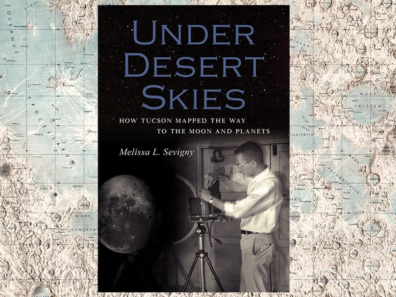
With the countdown underway to September's launch of the OSIRIS-REx asteroid sample return mission, University of Arizona alumna Melissa Sevigny, author of the new book "Under Desert Skies: How Tucson Mapped the Way to the Moon and Planets," talks about her love for geology and the planets - and how she undertook telling the story of the UA as the birthplace of planetary science.
How did you get involved in chronicling the history of the UA Lunar and Planetary Laboratory?
Growing up in Tucson under those beautiful dark skies, I have always been in love with the geology and the skies in the desert Southwest. First, I wanted to be a geologist, then an astrobiologist, and later, when I was in college as an environmental science major, I realized that I'm a storyteller. In 2006, when I was in my sophomore year, I was hired by Michael Drake, then the director of the Lunar and Planetary Laboratory, as a NASA Space Grant intern to collect stories and interviews from faculty members, staff and students to capture the institute's history for LPL's website.
What was Michael Drake's role in telling this story?
As I wrote in the book's prologue, he described my task in a single line when he hired me: "Capture the history of LPL from the old-timers while they're still alive and turn that into a transcript, if not a narrative." Michael Drake encouraged me as my mentor and my guide, but he was very hands-off in a good way. He had a wonderful skill to point people in a direction but then let them loose. He certainly believed that it was important to capture these stories, and he was interested in interdisciplinary work.
How did the project morph into a book?
Originally the idea was to collect transcripts of the interviews for the record, and eventually Mike and I cooked up the idea of a dedicated website about the history of LPL. The project turned out to be a wonderful marriage between science and storytelling, and by the end of the first year I was so excited about it that I asked Mike if I could keep working on it. At the time I wasn't thinking of anything that was going to have a wide audience, let alone a book. I just wanted to preserve some of the stories and the history. It wasn't until he passed away in 2011 that I picked it up again. I had written a draft as part of my honors thesis. I felt so affected by his passing, and that of several other people I had interviewed, that I wanted to see if I could pull out this project and take it one step further.
How did you go about structuring your material into a book?
It was a struggle. What I had were these disparate stories that spanned more than half a century, and it was a challenge to find a way to join all those stories together. I didn't want the book to be just an institutional history, but an account of the rise of the field of planetary science as a whole - how did this field come to be? I'm a fan of laying pages out on the floor and taking scissors to them to create an outline. I called on UA Special Collections and the LPL's Space Imagery Center, which host extensive archives where you could get lost for years if you wanted to. The process of collecting the interviews took about four years, and another two or so years to write the book. It's hard to say, because I had to pick up and put down the project at times.
How much material ended up in the book?
For the manuscript, I strung together quotes from more than 60 interviews I had collected. Each interview is about 10 pages long on average. There is a lot of material that never made it into the book. All in all, I probably had close to a thousand pages of material. I sifted through that to find the stories that captured my imagination most. There are many books on planetary science out there, so I wanted to tell the new stories that hadn't been told before. Many got left out, because otherwise the book would have been a thousand pages long. So I tried to fit these stories people fed me together like puzzle pieces, to create a coherent image about how the field came together. I didn't want the book to be a biography about Gerard Kuiper. He was such a forceful personality and could have easily taken over the entire book. There are so many characters, including students, too many to count, that came together in this amazing effort to create the field of planetary science. The most challenging point in the process is the publication deadline. It forced me to accept that this is now the point where I can no longer change anything, or add any more stories. That point comes about a year in advance before the book makes it onto the shelves in the bookstore. During that last round of editing, all you can do is fix spelling and grammar.
Tell us about some of the most unexpected or surprising things you discovered.
One of the most delightful things I discovered is how back in the day, amateurs could make such important contributions to a nascent scientific discipline. British amateur astronomer Ewen Whitaker, for example, who had no Ph.D., was so important in getting America to the moon. There was no field of planetary science, so there were only amateurs to tackle that goal of getting to the moon. Often when we tell science stories, we talk about Ph.D.s and academic accolades, and everything can get a little bit intimidating, but here there were so many people at the right place, at the right time, whose passion mattered much more than the training they had received. Another surprise was to learn how geologists changed their minds about the role catastrophic events play in shaping the planets and life on Earth. LPL was involved in the discovery of the Chicxulub crater made by the asteroid that wiped out the dinosaurs. Prior to that discovery, there was a widespread understanding among geologists that geology happens very slowly and gradually. Discoveries like Chicxulub or witnessing comet Shoemaker-Levy 9 slamming into Jupiter in 1994 provided evidence that these events really do happen. The giant impact theory about how the moon was created came about around that same time, and that caused that sea change. Another example is how infrared observations that hadn't been used for planetary science before became a tool for planetary discovery. For the book, all those threads had to be joined together.
What stories about the UA and LPL have not been told yet but should be?
I think there's a bigger story with all the geology stuff, and I may only be saying that because I love geology. Take the asteroid impact that coincided with the dinosaur extinction, for example. Luis Alvarez (who published a paper in 1980 with the hypothesis that a large asteroid had struck Earth at the time of the dinosaur extinction) got all the attention, but there was a UA grad student at the time, Alan Russell Hildebrand, who did a lot of work to pinpoint where it hit, leading to the discovery of the crater much later. There is so much that could be expanded out into bigger stories. One story I can think of is about the scientists who make careers out of working on spacecraft missions. If a mission fails, if the spacecraft crashes or disappears, all of a sudden there is no publication on their resume. Scientists going into that are taking a huge risk with their livelihoods. And of course, Steward Observatory and the UA’s Department of Astronomy have a long, rich history, and so does Kitt Peak. I barely brushed on their stories in the book because I wanted to stay focused on planetary science.
How do you see the UA's role in space sciences then and now?
When LPL first started, Tucson had this important role to play in mapping the moon. It was the only place where anyone was studying the moon. Then President Kennedy made his famous announcement, "We're going to the moon," but there was no one who had maps of the moon. Kuiper and his team were making those maps. The UA has had such an important role in space exploration, and as a crucible for students, churning out researchers working on future missions. OSIRIS-REx is going to be such a great mission.
Do you have any other books in the works?
"Mythical River" was published just this past March. It's about water in the Southwest, specifically how we constantly bring water into the Southwest from far away to solve our problems, another very science-heavy book, but more personal, some memoir in there. I write about a belief that there was this mythical river, Buenaventura, which was made up in 1776 and appeared on maps for 75 years, which I use as a metaphor for the misguided idea that water will just magically appear when we need it. It was really believed to be there. Americans at the time had no experience with dry places, and that legacy still persists today. The book also tells the story of our modern canals and dams, and restoration efforts to live in a more sustainable way in the desert.

UA Planetary Science Gets Stamps of Approval
By Daniel StolteUA Planetary Science Gets Stamps of Approval

By Daniel Stolte, University Relations - Communications, May 25, 2016
When a University of Arizona planetary scientist persuaded NASA to point the Hubble Space Telescope at Jupiter and Uranus to gather clues about the atmospheres of the two giant gas planets, he had no idea that his images might end up years later in mailboxes across the nation and possibly the world.
On March 28, 2004, three of Jupiter's largest moons - Io, Ganymede and Callisto - came together in a rare alignment, casting their shadows onto the Earth-facing side of the planet to form a triple eclipse.
Erich Karkoschka, a senior staff scientist in the UA's Lunar and Planetary Laboratory, had been waiting for this moment and he was ready. NASA had granted him 40 minutes - the viewing time offered by Hubble orbiting Earth once - to observe how the three moons danced around their host planet.
"Having three shadows and two moons transiting the disk of Jupiter at the same time is very rare," Karkoschka said. "It hadn't happened for 60 years when I made the proposal to use Hubble to observe this event."
Hubble took that image with its "infrared eyes," a camera developed by a team of UA astronomers and engineers, using three different optical filters. Because human eyes can't see infrared light, those wavelengths are translated into false-color renditions of blue, green and red.
"You can make the different features visible that way, and once you are able to see those differences, you can do better science as well," Karkoschka explained. "For this particular color image, the rationale was mostly to get a pretty image of this rare event."
Most images of Uranus, like those taken by the Voyager 2 space probe during its flyby in 1986, revealed a hazy, pale blue disk that looked rather bland and not too exciting, said Karkoschka, who took his image of Uranus in 2003, this time using Hubble's Advanced Camera for Surveys.
Because his image combined three filters, he was able to get a more colorful and revealing rendition of features in Uranus' atmosphere, such as three bright red glowing clouds in the planet's northern hemisphere.
Together with his equally colorful image of Jupiter, Karkoschka's Uranus picture features in a special edition of stamps, "Views of Our Planets," which the U.S. Postal Service officially will release on Tuesday at the World Stamp Show, the world's largest philatelic event, held in the U.S. only once every decade.
"During the modern era of space exploration, the planets of our solar system have been viewed with increasing clarity, thanks to the distant voyages of unmanned spacecraft and the development of ever-more powerful telescopes," according to the design brief. "With this pane of stamps, the Postal Service showcases some of the more visually compelling full-disk images of the planets obtained during this era."
Said Karkoschka: "I was granted one orbit in one specific year, and so I looked for the best occasion in that year, and then I realized if it was going to be on that date, I could get something that really doesn't happen very often. So I was kind of lucky."
Karkoschka has observed the giant planets on telescopes around Tucson and in Chile, and using the Hubble Space Telescope, to understand the structures of their atmospheres. From this work, he determined the vertical and horizontal distribution of hazes, clouds and methane.
"On the gas giants, there is no surface anywhere close to where we can see," he said. "There may be a very small, solid core, perhaps similar in size to Earth, while most of the outer part is hydrogen, helium and other gases including methane."
On all those planets, Karkoschka has been researching the cloud levels and what the clouds are like. Once he had images taken over several years, he could see how the clouds and their altitudes changed.
Jupiter's clouds consist mainly of ammonia crystals, while similar features spotted on Uranus are made up of frozen methane. Because it takes Uranus more than 84 Earth years to complete a trip around the sun, studying seasonal changes takes generations of researchers.
"In the 1990s, we were seeing the southern hemisphere, and it didn't look too interesting," Karkoschka said. "But with the equinox in 2007, more of the northern hemisphere came into view and there were really unique clouds that appeared red in those images. Those clouds were the first really interesting features that we could see on Uranus."
Gradually, atmospheric details first spotted by Voyager 2 became more and more interesting, and tracking them allowed Karkoschka to accurately determine the planet's spin for the first time.
"We really could see activity on Uranus, and that was exciting," he said. "The bluish part is the southern hemisphere, and the three red clouds are in the northern hemisphere, rising above the general haze spreading out below them. In the meantime, we have seen even brighter clouds. You can follow them for a few weeks or months, but after that they change or disappear."
Scientists are still a long way away from understanding the causes of those changes.
"The northern hemisphere of Uranus appears to be much more active now than the southern hemisphere," Karkoschka said. "We don't know why. If we wait for another 40 years for the season to change, and if then only the southern hemisphere is active, we know it's a seasonal effect. But if the activity is still only in the northern hemisphere, then we'll know there really is some intrinsic asymmetry at work."
By then, mailing letters may well be a thing of the past, with the stamps depicting our planets having found their way into stamp collections around the world.

Skimming the Clouds of Jupiter
Daniel StolteSkimming the Clouds of Jupiter

Daniel Stolte, University Relations - Communications, July 5, 2016
(An earlier version of this story was published on June 20, 2016)
After cruising through space for five years, NASA's Juno spacecraft, the fastest man-made object, fired its main thrust engine to brake its fall toward Jupiter, the largest planet in our solar system. Its mission: to gather clues shrouded under Jupiter's thick layers of clouds that reveal what the planet is made of on the inside, and to help answer some of the most fundamental questions about how planets form from swirling clouds of gas and dust.
During its critical braking maneuver, carefully calculated to place the Juno probe in a stable orbit around the giant gas planet, UA planetary sciences professor William Hubbard joined a group of about 30 scientists involved with the mission at the Jet Propulsion Laboratory in Pasadena, California, anxiously awaiting confirmation from the windmill-shaped spacecraft that all went well.
"It's a very crucial maneuver," Hubbard said while preparing for the probe's arrival at Jupiter. "The white-knuckle period will be when the spacecraft comes in over the north pole of Jupiter, and then the main engine will fire for about half an hour. If that were to be unsuccessful, the probe would shoot past Jupiter and go off into interplanetary space."
Hubbard has been waiting for that moment for his whole career.
"Having a geophysical orbiter at Jupiter has been a top priority for a number of people in the scientific community for many years," he says. "Our objective is to get at a close range of a giant planet. And when you get that close to Jupiter, you begin to see details of its magnetic field and its gravity field that you can't see at long range. Some of those details will tell us about the interior of Jupiter."
Scientists Vexed by Question
Despite having pointed telescopes at Jupiter for more than 400 years, mankind has much more to learn about the planet that would eclipse 11 Earths lined up in a row. One question, in particular, that has vexed scientists is whether Jupiter hides a solid core of elements heavier than those making up its bulk - hydrogen and helium - or whether those two gases simply become more and more compressed all the way to the center.
"Whether there is evidence for a large, massive core inside Jupiter, as is predicted by various theories about the origins of Jovian planets, is one of the things we hope to learn fairly quickly," Hubbard says.
With more and more exoplanets being discovered far, far away from the reach of space probes, scientists look to our very own gas giant to help them understand how such planets form, how they evolve over time and what they look like inside. Current belief holds that they will not form directly from clouds of hydrogen-rich material that collapses to give birth to stars including our sun, but instead they need a trigger of some form of massive, denser material, Hubbard explains.
As co-investigator on the mission, Hubbard is part of a team that oversees the gravity experiment on the spacecraft, which is expected to reveal clues about Jupiter's hidden interior. Since Jupiter is not a solid, perfectly spherical and homogeneous ball, but rather like a spinning bag filled with a swirling mix of gases, fluids and possibly solid matter, its gravitational field reflects those chaotic conditions in the planet's interior. Its tug on the Juno spacecraft intensifies or lessens by tiny, but measurable, amounts as it travels around the planet.
A highly synchronized, locked loop of radio wave communication between Juno and the antenna array at NASA's Goldstone Deep Space Communications Complex in California’s Mojave Desert will detect Juno moving toward or away from Earth under Jupiter's gravitational pull - shifts on the magnitude of microns.
"Think of how much your weight changes when a mosquito lands on your head," Hubbard says. "Juno's gravity experiment will potentially be capable of measuring signals at the level of one-hundredth of that amount."
After removing the effects of many influences interfering with the gravity measurements - a "terrible job," according to Hubbard - a three-dimensional dataset will emerge, representing Jupiter's gravitational field. Because its shape depends on the planet's interior structure as well as the tugging from its nearest large moons, the gravitational field will allow Hubbard and his collaborators to make inferences about Jupiter's interior.
"We will see terms in Jupiter's gravity field that we can't see from Earth, and some of these terms are related to the interior structure of Jupiter," Hubbard explains. "Others are related to its interior dynamics - for example, how much material is moved around in Jupiter's interior through convection, as opposed to if it were a quiescent planet."
'Money Part of the Orbit'
Unlike any other spacecraft that visited Jupiter before, Juno will enter an orbital trajectory taking it over Jupiter's north and south poles once every 14 days. During what Hubbard calls the "money part of the orbit," the probe will approach Jupiter as close as 5,000 kilometers (about 3,000 miles) above its clouds.
"Most of the time, though, it will be very far away from Jupiter," Hubbard says, "partly to protect it from Jupiter's intense radiation, and partly because you can't carry enough fuel to maintain a real tight orbit around a planet with such a strong gravitational field."
Jupiter's huge magnetic field, which, if it were visible, would appear as big as the full moon when seen from Earth, captures the solar wind and accelerates it into a deathly rain of radiation. Juno's instruments are encased in a titanium vault and its orbit is designed to avoid the peaks of Jupiter's radiation belts as much as possible.
As the first spacecraft to be diving underneath Jupiter's radiation belts, Juno will be able to make observations using microwaves that will provide glimpses into Jupiter's atmosphere to much deeper levels than was possible before.
"Jupiter's powerful radiation belts contain high-energy electrons that emit precisely at those microwave wavelengths," Hubbard says, "so you can't see deep into Jupiter at those wavelengths by looking from the Earth, because there is too much background noise from the radiation belts. But if you can get underneath the radiation belts, which is what Juno will do, then you can probe the atmosphere in those wavelengths."
Potentially, scientists will be able to see several hundred kilometers below the clouds, much deeper than NASA's Galileo entry probe that descended into Jupiter's atmosphere in 1995.
Juno's measurements are expected to also reveal clues about how much water there is in Jupiter's atmosphere, which helps determine which planet formation theory is correct or if new theories are needed. In addition, the data will offer conclusions about whether Jupiter formed at its current location in the solar system or migrated to its present orbit over time.
Because Juno won't be able to stay out of harm's way forever, its instruments and electronic components are expected to deteriorate over the course of the mission - 20 months for a total of 37 orbits. Before the spacecraft becomes uncontrollable, NASA's engineers will set a final course plunging the spacecraft into Jupiter, where it will burn up without leaving a trace, to avoid the risk of it contaminating one of Jupiter's potentially life-friendly moons such as Europa.
Practicing Patience
Hubbard can't wait for the probe to begin streaming data to Earth that he has awaited for years.
"When you work in outer solar system exploration as opposed to inner solar system exploration, you learn a special kind of patience," he says. "The distances are much greater; the orbital periods are much greater; it takes longer to get there; so when you're involved in these projects, you sort of grow old together, you see everybody turn into old men and old women over the course of the whole endeavor."
NASA's Jet Propulsion Laboratory in Pasadena, California, manages the Juno mission for the principal investigator, Scott Bolton, of Southwest Research Institute in San Antonio. The Juno mission is part of the New Frontiers Program.
OSIRIS-REx Spacecraft Takes a Selfie in Space
Daniel Stolte -OSIRIS-REx Spacecraft Takes a Selfie in Space

Daniel Stolte - University Communications, Sept. 28, 2016
Two weeks after launch, the OSIRIS-REx spacecraft found itself 3.9 million miles - about 16 times the Earth-moon distance - away from Earth, hurtling around the sun at 19 miles per second. Last week for the first time, engineers and scientists turned on the spacecraft's instruments.
The performance of the University of Arizona-led asteroid-sampling spacecraft mission so far has team members gleaming with smiles often seen from new parents.
"We launched within 180 milliseconds of our opening launch window, and that set the tone for the performance of this mission," said Dante Lauretta, professor in the UA's Lunar and Planetary Laboratory and OSIRIS-REx principal investigator. "We didn't work any anomalies during the countdown; launch was absolutely flawless; the spacecraft separated from the rocket with no issues; we got the spacecraft stabilized and powered on, and it was talking to two Deep Space Network antennas immediately."
Since then, OSIRIS-REx extended its solar panels into cruise configuration to harvest power from the sun and embarked on its journey to asteroid Bennu, periodically performing what engineers call "routine momentum dumps" - short firings of thrusters to compensate for momentum induced by the spacecraft's reaction wheels, which are used to control the attitude of the spacecraft.
Then, last week, came the moment of truth - a moment both eagerly awaited and dreaded by the mission's team members. OSIRIS-REx was about to switch on its instruments, for the first time not in the controlled environment of a testing chamber, hooked up to monitoring equipment and under the watchful eyes of engineers.
This time, it would be in the cold emptiness of deep space.
Like a Newborn's First Breaths
"Launch is like birth," said Bashar Rizk, senior staff scientist for OCAMS, the OSIRIS-REx Camera Suite, the "eyes" of the spacecraft. "It's like watching the newborn take its first breaths. During the instrument checkout, we exercised every piece of copper in all cameras, the circuits, the detectors, the focus mechanism, everything."
All of the spacecraft's instruments powered up as expected and all were able to acquire data and downlink to Earth, Lauretta reported, after passing through the processing pipeline and finally onto the mission's science processing servers.
"Our feeling going into the instrument checkout was very nervous," said Sara Knutson, a senior operations engineer and alumna of the UA College of Engineering who is responsible for science operations planning and making sure the instruments function as they should to achieve the mission's science goals.
"The spacecraft is millions of miles away, and there is nothing I can do if (an instrument) doesn't turn on."
But nervousness quickly gave way to excitement, and "there were a lot of 'proud parents' in the crowd and a sense of elation," said Knutson, who was at Lockheed Martin's headquarters in Littleton, Colorado, where the spacecraft was built, monitoring the downlink.
"We powered the instruments on in series - first MapCam, then SamCam, followed by PolyCam - and when the first of 150 images came down at 11 a.m. on Monday, Sept. 19, there was cheering and clapping."
Developed and built at the UA, the three cameras make up OCAMS, an instrument designed to support the mission to the asteroid through all of its phases, from approach to sample collection.
Similar to a scout's spyglass, PolyCam will be the first to spot the asteroid from a million miles away. Once closer, it will help identify dangerous areas on the asteroid's surface by spotting and mapping large boulders and rocks, and characterize a dozen prospective sample sites in detail. The medium-resolution Mapping Camera, or MapCam, will search for potential hazards to the spacecraft once it gets to the asteroid, such as small rocks trapped in orbit, or outgassing plumes. MapCam will map the entire surface of Bennu from a safe distance of three miles. Once a suitable sampling site has been identified, the Sampling Camera, or SamCam, will continuously document the spacecraft's final trip onto the asteroid's surface and the sampling sequence.
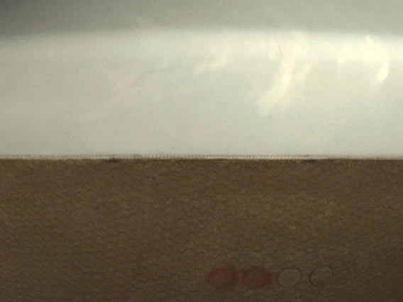
In addition to OCAMS, which will peer out into the void of space and won't see much other than stars until OSIRIS-REx approaches Bennu, StowCam, a small camera mounted next to the probe's sampling capsule, also opened its shutter for the first time last week, taking the first selfie of OSIRIS-REx in space.
According to Knutson, many considerations and precautions go into acquiring images through the spacecraft's instruments, with the process involving 30 to 40 people in some way. Every command to the spacecraft is carefully planned on the ground and translated into computer code, which is then checked multiple times to ensure that no maneuver is initiated that may put the spacecraft or any of its instruments in danger.
'Things Heat Up Very Fast'
The biggest risk, according to Bradley Williams, OCAMS systems engineer and also a graduate of the College of Engineering, is direct sunlight, with visible light being the least of concerns. Much more dangerous are wavelengths that we on Earth don't have to worry too much about because our atmosphere filters much of them out before they reach the ground. But in space, there is constant radiation danger and "things heat up very fast," and pointing OSIRIS-REx's cameras directly at the sun would "fry the image detectors, like a magnifying glass on an ant," Williams said.
"Once we get to Bennu, we'll be facing essentially a black chunk of coal, which gets very hot, relatively speaking," he said. "You have to design your instruments and check them so that you can find out their temperature performance and tolerance. Everything we want to take pictures of has to be lit by something, either the sun or by starlight, and we have to look at the exposure times necessary to capture the images we need. All these things go into taking an image."
At the UA's Drake Building, which serves as the OSIRIS-REx Science Processing and Operations Center, team members such as Knutson and Williams are responsible for writing what they call the command products - instructions that the science instruments can understand and execute.
"We write those line by line with code," Knutson said, "then we do a variety of testing on simulation testbeds on the ground, and then everything is radiated through Lockheed Martin, from there using the pipeline of the Flight LAN at NASA's Jet Propulsion Laboratory, which monitors everything that is going to the Deep Space Network to be sent to the spacecraft.”
Last week, it took 10 seconds for the data to arrive at the spacecraft, and 10 seconds for its responses to come down, Knutson said.
"In contrast, when we are at Bennu, it will take 13 minutes to get it all up there, and another 13 minutes for the spacecraft's response to come back to us," she said.