Introduction
So much of my work is in the digital world, and I wanted to make something related to my work that I could actually
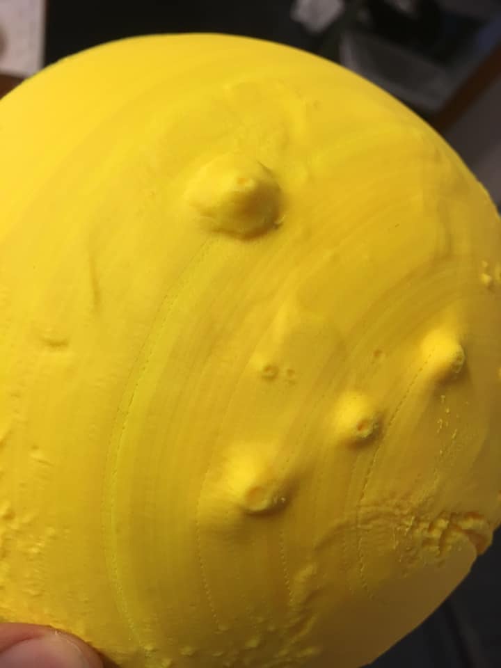
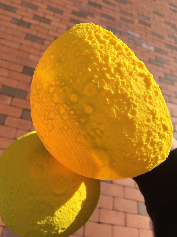
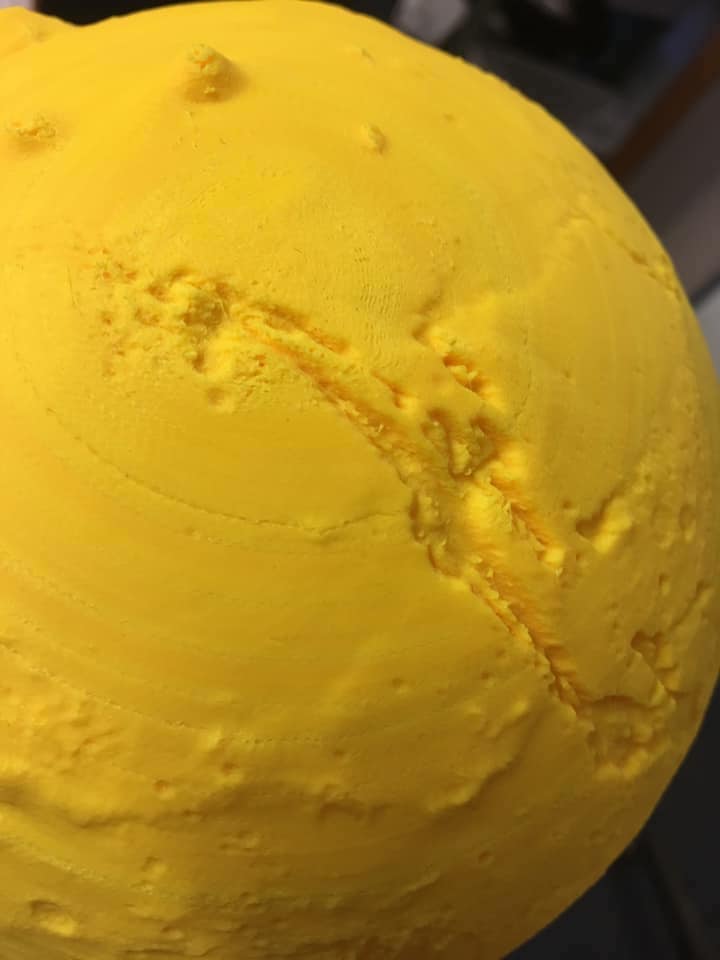
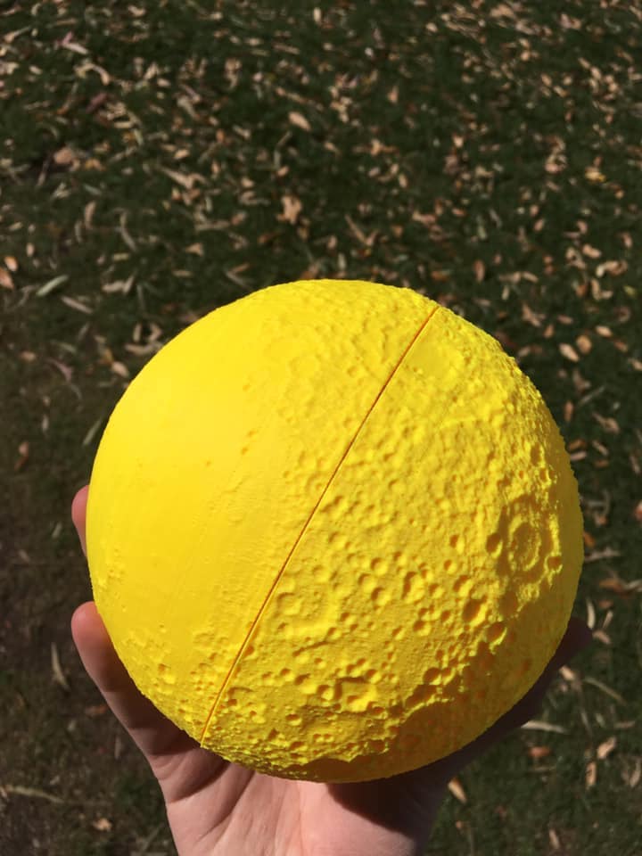
My 3D models of the Moon and Mars have been draft-printed by Dr. Steve Kortenkamp, professor of Planetary Science at the University of Arizona, researcher, and author of at least 20 children's books. On the right are some images I took of his models. Note that the ring-like effects in some of the models are artifacts of the 3D printing process.
What Do These Models Look Like?
In the 3D model below, you are looking at a spherical cap of Earth. North America is shown up-side down. Greenland is in the lower left, South America is in the upper left, and Alaska in the lower right. The Atlantic Ocean is on the left and the Pacific Ocean is on the right.
I would have posted a full spherical model of Earth here, but it's 100 MB, which would take a lot of time to load and could be a burden on mobile devices.
The following 3D model of Earth's northern hemisphere may take some time to load. Meanwhile, the background image is the result of a creative team project I spearheaded as an undergraduate: a photomosaic of the Andromeda Galaxy.
Be sure to try moving the 3D model around!
What's Special About These 3D Models?
You may have heard it said that Earth is the most spherical object in the Solar System. In spite of its remarkable sphericity, it actually is more closely an ellipsoid than a perfect sphere. My models use digital terrain and bathymetry data taken by airplanes and spacecraft, which reference the elevation data to an ellipsoid (for more information, check out the science of geodesy). My models reconstruct the Earth using this reference ellipsoid, and use a similar process for the Moon and Mars. This makes their shape more accurate than if I had assumed they were a sphere.
I then took some artistic liberties.
The difference in height between the highest mountain and the deepest ocean trench is a mere scratch on the surface of a marble. Because of this, I would either need to print these models very large (the size of a beach ball) or use an extremely high-resolution 3D printer in order to show topography on the surface of Earth. Unfortunately, printing large models is too expensive and current 3D printers lack the resolution to print differences this small. For this reason, I exaggerate the topography by a factor of 50 to make it easier to see (or feel) the shapes of the continents. Finally, because the many small islands would be prohibitively difficult to print or handle, I developed an algorithm to gently smooth the model.
Future Work
- I'd like to post links on this website for my higher-resolution models.
- I'd like to post my models of the Moon and Mars.
- I'd like to publish my code so others can do similar projects.
- I'm interested in offering these for people with visual impairments.
- I'd like to someday make a database of space-themed 3D models and related resources for science educators to download and print.